Tamanredjo | |
|---|---|
Resort and town | |
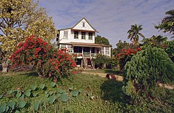
 Director's house in Sorgvliet. | |
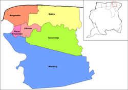
 Map showing the resorts of Commewijne District. Tamanredjo | |
| Coordinates: 5°46′54″N 55°1′10″W / 5.78167°N 55.01944°W | |
| Country | |
| District | Commewijne District |
| Area | |
| • Total | 512 km2 (198 sq mi) |
| Elevation | 6 m (20 ft) |
| Population (2012 census)
[1] | |
| • Total | 6,601 |
| • Density | 13/km2 (33/sq mi) |
| Time zone | UTC-3 (AST) |
Tamanredjo ( Javanese: ꦠꦩꦤꦽꦗ; lit. 'Prosperous Garden Village') is a resort and town in Suriname, located in the Commewijne District. Its population at the 2012 census was 6,601. [1]
Tamanredjo was founded in 1937 as village for Javanese immigrants. [2] As of 2012, the Javanese still form among the biggest ethnic group. [1] The town was connected to the East-West Link in 1960s, and is one of the larger towns of the Commewijne District. [2]
Another village in the resort is Stolkertsijver.
Sorgvliet is a former coffee plantation on the Commewijne River, [3] which was founded in 1742 by Phaff [4] which is known for its monumental Director's house. [2]
References
- ^ a b c "Resorts in Suriname Census 2012" (PDF). Retrieved 17 May 2020.
- ^ a b c "Distrikt Commewijne 2". Suriname.nu. Retrieved 17 May 2020.
- ^ "Plantage Sorgvliet". Suriname Plantage (in Dutch). Retrieved 17 May 2020.
- ^ "DE HERKOMST EN DE BETEEKENIS VAN SURINAAMSCHE PLANTAGENAMEN". Doc Player (in Dutch). Retrieved 17 May 2020.
External links
Wikimedia Commons has media related to
Tamanredjo.
Wikimedia Commons has media related to
Sorgvliet.
