This article includes a list of general
references, but it lacks sufficient corresponding
inline citations. (April 2013) |
| Symington | |
|---|---|
 | |
Location within
South Lanarkshire | |
| Population | 740 (mid-2020 est.) [1] |
| OS grid reference | NS995351 |
| Council area | |
| Lieutenancy area | |
| Country | Scotland |
| Sovereign state | United Kingdom |
| Post town | Biggar |
| Postcode district | ML12 |
| Police | Scotland |
| Fire | Scottish |
| Ambulance | Scottish |
| UK Parliament | |
| Scottish Parliament | |
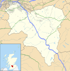
Symington is a small village in South Lanarkshire, Scotland, 3 miles (5 km) southwest of Biggar, 10 miles (16 km) east of Douglas and 13 miles (21 km) southeast of Carluke. Geographical features near Symington include Tinto Hill, the Coulter Hills and the River Clyde. [2] A map by Pont in 1596 showed two St John's Kirks in a small settlement, and another map by Roy in 1754 showed a mill to the east. [3]
History
The Symington, Biggar and Broughton Railway operated initially between 1858 and 1861 between Symington and Peebles (West), with nine stations, including Stobo railway station. Its successor was the Caledonian Railway Main Line.
Recognition
Symington was painted by John Pairman of Biggar around 1830. [4]
See also
- Symington, South Ayrshire
- Symington Family Estates
- List of places in South Lanarkshire
- List of places in Scotland
References
- Forbes, John (1845). The New Statistical Account of Scotland. Vol. 6. Edinburgh and London: William Blackwood and Sons. pp. 867–872. Retrieved 3 January 2018.
- ^ "Mid-2020 Population Estimates for Settlements and Localities in Scotland". National Records of Scotland. 31 March 2022. Retrieved 31 March 2022.
- ^ "Lanarkshire 39:3". NLS. Ordnance Survey. Retrieved 29 June 2020.
- ^ The Making of Scotland, Robin Smith, Canongate Books Ltd, 2001, ISBN 1-84195-170-6
- ^ Art UK[ dead link]
External links
History
- RCAHMS record for Symington House
- RCAHMS record for Symington, Manse Road, Symington Mill
- Gazetteer for Scotland: Symington
- National Archives: Symington, Biggar and Broughton Railway
- National Archives: Symington Parochial Board/Parish Council
- National Archives: Symington School Board
- British Listed Buildings: Symington House
- Vision of Britain: Symington
Local government and Services
- South Lanarkshire Council: Tinto Primary school and Nursery Class, Symington, HM Inspection , April 2009
- Local By-elections
- Symington Kirk
- Symington Weather Station
Recreation

