This article needs additional citations for
verification. (December 2009) |
| Sylvan Pass | |
|---|---|
 Sylvan Lake on Sylvan Pass | |
| Elevation | 8,524 ft (2,598 m) [1] |
| Location |
Park County, Wyoming, United States |
| Range | Absaroka Range |
| Coordinates | 44°27.9′N 110°7.7′W / 44.4650°N 110.1283°W |
Sylvan Pass (el. 8,524 feet (2,598 m)) is a mountain pass located in the Absaroka Range in Yellowstone National Park in Wyoming. The pass provides access to the park from the east entrance.
The pass was named after nearby Sylvan Lake (derived from medieval Latin sylvānus, from Latin Silvānus, god of the woods, from silva, forest), and was formed by frost action breaking the rocks. The park road through the pass was closed during winter but is now open to visitors throughout winter. The road is maintained to allow access via snowmobile, snow coach, and cross-country skiing. In the 2007–08 season it cost the parks service in excess of $200,000 to keep it open and avalanche control measures were put in place.
The Sylvan Pass route is the only way to enter/exit Yellowstone National Park from the East Entrance.
Sylvan Pass is the low point of the saddle between Hoyt Peak and Top Notch Peak.
The original road through the pass was designed by Captain Hiram Chittenden of the Army Corps of Engineers.
Climate
Sylvan Lake (Yellowstone Park) is located near the summit of Sylvan Pass at an altitude of 8420 feet (2566 m). Sylvan Lake has a subarctic climate ( Köppen Dfc), characterized by long, cold winters and short summers.
| Climate data for Sylvan Lake, Wyoming, 1991–2020 normals, 1983-2020: 8420ft (2566m) | |||||||||||||
|---|---|---|---|---|---|---|---|---|---|---|---|---|---|
| Month | Jan | Feb | Mar | Apr | May | Jun | Jul | Aug | Sep | Oct | Nov | Dec | Year |
| Record high °F (°C) | 55 (13) |
60 (16) |
60 (16) |
69 (21) |
77 (25) |
86 (30) |
86 (30) |
85 (29) |
81 (27) |
73 (23) |
60 (16) |
48 (9) |
86 (30) |
| Mean maximum °F (°C) | 41.7 (5.4) |
44.6 (7.0) |
53.8 (12.1) |
60.4 (15.8) |
66.6 (19.2) |
75.1 (23.9) |
80.5 (26.9) |
79.5 (26.4) |
74.6 (23.7) |
63.5 (17.5) |
49.2 (9.6) |
38.9 (3.8) |
81.5 (27.5) |
| Mean daily maximum °F (°C) | 27.3 (−2.6) |
30.2 (−1.0) |
38.5 (3.6) |
44.9 (7.2) |
52.9 (11.6) |
60.5 (15.8) |
71.1 (21.7) |
70.2 (21.2) |
60.1 (15.6) |
45.6 (7.6) |
33.3 (0.7) |
25.6 (−3.6) |
46.7 (8.2) |
| Daily mean °F (°C) | 17.6 (−8.0) |
18.8 (−7.3) |
26.1 (−3.3) |
32.2 (0.1) |
40.6 (4.8) |
47.4 (8.6) |
55.8 (13.2) |
54.7 (12.6) |
46.7 (8.2) |
35.1 (1.7) |
23.8 (−4.6) |
16.5 (−8.6) |
34.6 (1.5) |
| Mean daily minimum °F (°C) | 7.9 (−13.4) |
7.4 (−13.7) |
13.6 (−10.2) |
19.4 (−7.0) |
28.2 (−2.1) |
34.2 (1.2) |
40.6 (4.8) |
39.2 (4.0) |
33.1 (0.6) |
24.6 (−4.1) |
14.3 (−9.8) |
7.5 (−13.6) |
22.5 (−5.3) |
| Mean minimum °F (°C) | −16.1 (−26.7) |
−16.8 (−27.1) |
−9.1 (−22.8) |
0.2 (−17.7) |
13.1 (−10.5) |
26.2 (−3.2) |
32.7 (0.4) |
30.9 (−0.6) |
22.1 (−5.5) |
6.7 (−14.1) |
−8.5 (−22.5) |
−15.8 (−26.6) |
−23.9 (−31.1) |
| Record low °F (°C) | −44 (−42) |
−44 (−42) |
−29 (−34) |
−16 (−27) |
−3 (−19) |
14 (−10) |
17 (−8) |
19 (−7) |
−1 (−18) |
−16 (−27) |
−28 (−33) |
−46 (−43) |
−46 (−43) |
| Average precipitation inches (mm) | 3.97 (101) |
3.28 (83) |
3.69 (94) |
4.20 (107) |
3.90 (99) |
3.49 (89) |
1.54 (39) |
1.45 (37) |
2.46 (62) |
3.50 (89) |
4.18 (106) |
4.32 (110) |
39.98 (1,016) |
| Source 1: XMACIS2 [2] | |||||||||||||
| Source 2: NOAA (Precipitation) [3] | |||||||||||||
The weather station, Yellowstone NP East ENT, is situated roughly halfway between the summit of Sylvan Pass and Pahaska Tepee, at an elevation of 6954 feet (2120 m).
| Climate data for Yellowstone NP East ENT, Wyoming, 1991–2020 normals, 2001–2020 snowfall: 6954ft (2120m) | |||||||||||||
|---|---|---|---|---|---|---|---|---|---|---|---|---|---|
| Month | Jan | Feb | Mar | Apr | May | Jun | Jul | Aug | Sep | Oct | Nov | Dec | Year |
| Record high °F (°C) | 52 (11) |
51 (11) |
60 (16) |
72 (22) |
82 (28) |
89 (32) |
93 (34) |
91 (33) |
87 (31) |
82 (28) |
63 (17) |
51 (11) |
93 (34) |
| Mean maximum °F (°C) | 43.9 (6.6) |
44.4 (6.9) |
52.5 (11.4) |
60.8 (16.0) |
72.8 (22.7) |
81.6 (27.6) |
87.2 (30.7) |
86.1 (30.1) |
81.3 (27.4) |
69.1 (20.6) |
53.5 (11.9) |
41.8 (5.4) |
88.2 (31.2) |
| Mean daily maximum °F (°C) | 29.7 (−1.3) |
32.3 (0.2) |
39.4 (4.1) |
47.0 (8.3) |
56.9 (13.8) |
67.0 (19.4) |
77.7 (25.4) |
76.9 (24.9) |
66.7 (19.3) |
51.3 (10.7) |
37.0 (2.8) |
28.5 (−1.9) |
50.9 (10.5) |
| Daily mean °F (°C) | 16.9 (−8.4) |
19.0 (−7.2) |
25.3 (−3.7) |
34.3 (1.3) |
43.3 (6.3) |
50.9 (10.5) |
58.4 (14.7) |
57.0 (13.9) |
48.7 (9.3) |
37.3 (2.9) |
25.2 (−3.8) |
16.6 (−8.6) |
36.1 (2.3) |
| Mean daily minimum °F (°C) | 4.0 (−15.6) |
5.7 (−14.6) |
11.2 (−11.6) |
21.6 (−5.8) |
29.6 (−1.3) |
34.8 (1.6) |
39.0 (3.9) |
37.1 (2.8) |
30.7 (−0.7) |
23.3 (−4.8) |
13.3 (−10.4) |
4.7 (−15.2) |
21.2 (−6.0) |
| Mean minimum °F (°C) | −17.4 (−27.4) |
−22.5 (−30.3) |
−8.4 (−22.4) |
6.1 (−14.4) |
17.1 (−8.3) |
27.9 (−2.3) |
32.1 (0.1) |
30.0 (−1.1) |
23.0 (−5.0) |
8.7 (−12.9) |
−2.5 (−19.2) |
−16.0 (−26.7) |
−27.5 (−33.1) |
| Record low °F (°C) | −32 (−36) |
−39 (−39) |
−33 (−36) |
−10 (−23) |
8 (−13) |
24 (−4) |
27 (−3) |
21 (−6) |
14 (−10) |
−17 (−27) |
−21 (−29) |
−31 (−35) |
−39 (−39) |
| Average precipitation inches (mm) | 2.11 (54) |
1.95 (50) |
1.89 (48) |
2.03 (52) |
2.56 (65) |
2.64 (67) |
1.38 (35) |
1.33 (34) |
1.94 (49) |
2.53 (64) |
2.89 (73) |
2.87 (73) |
26.12 (664) |
| Average snowfall inches (cm) | 28.6 (73) |
27.5 (70) |
20.8 (53) |
14.1 (36) |
3.4 (8.6) |
0.8 (2.0) |
0.0 (0.0) |
0.0 (0.0) |
1.1 (2.8) |
9.0 (23) |
19.5 (50) |
28.8 (73) |
153.6 (391.4) |
| Source 1: NOAA [4] | |||||||||||||
| Source 2: XMACIS2 (snowfall, records & monthly max/mins) [5] | |||||||||||||
-
 Sylvan Pass Loop, East Side, 1921
 -
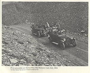 1st automobile over pass, 1914


Notes
- ^ "Sylvan Pass". Geographic Names Information System. United States Geological Survey, United States Department of the Interior.
- ^ "xmACIS2". National Oceanic and Atmospheric Administration. Retrieved November 19, 2023.
- ^ "Sylvan Lake, Wyoming 1991-2020 Monthly Normals". Retrieved November 19, 2023.
- ^ "Yellowstone NP East ENT, Wyoming 1991-2020 Monthly Normals". Retrieved November 19, 2023.
- ^ "xmACIS". National Oceanic and Atmospheric Administration. Retrieved November 19, 2023.
Yellowstone National Park – lake and environs | ||
|---|---|---|
Historic structures and other attractions in the
Yellowstone Lake, West Thumb, South and East Entrance areas | ||
| Structures and history |  | |
| West Thumb Geyser Basin | ||
| Geography and geology |
| |
| Authority control databases: National |
|---|
|
| This article about a location in Wyoming is a stub. You can help Wikipedia by expanding it. |