Sugar Camp, West Virginia | |
|---|---|
 Sugar Camp Location within the state of West Virginia  Sugar Camp Sugar Camp (the United States) | |
| Coordinates: 39°14′27″N 80°41′36″W / 39.24083°N 80.69333°W | |
| Country | |
| State | |
| County | |
| Elevation | 843 ft (257 m) |
| Time zone | UTC-5 ( Eastern (EST)) |
| • Summer ( DST) | UTC-4 (EDT) |
| GNIS ID | 1689595 [1] |
Sugar Camp is an unincorporated community in Doddridge County, West Virginia, United States. The community is located along West Virginia Route 18 at the confluence of Toms Fork and Meathouse Fork. [2]
References
Municipalities and communities of
Doddridge County, West Virginia, United States | ||
|---|---|---|
| Town | 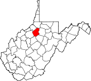 | |
|
Unincorporated communities | ||
|
| This article about a location in Doddridge County, West Virginia is a stub. You can help Wikipedia by expanding it. |