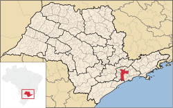
Subprefecture of São Mateus | |
|---|---|
 Location of the Subprefecture of São Mateus in São Paulo | |
 Location of municipality of São Paulo within the State of São Paulo | |
| Country | |
| Region | Southeast |
| State |
|
| Municipality |
|
| Administrative Zone | East 1 |
| Districts | São Mateus, São Rafael, Iguatemi |
| Government | |
| • Type | Subprefecture |
| • Subprefect | Ademir Aparecido Ramos |
| Area | |
| • Total | 45.5 km2 (17.6 sq mi) |
| Population (2008) | |
| • Total | 436,329 |
| Website | Subprefeitura São Mateus (Portuguese) |
The Subprefecture of São Mateus is one of 32 subprefectures of the city of São Paulo, Brazil. It comprises three districts: São Mateus, São Rafael, and Iguatemi. [1]
References
- ^ Official Subprefecture Website (Portuguese) Archived 2011-01-27 at the Wayback Machine