-
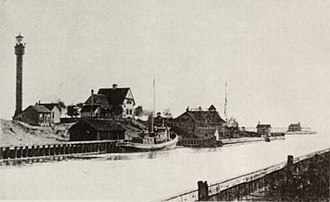 Sturgeon Bay Canal from a postcard postmarked in 1899
 -
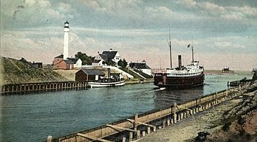 From a postcard postmarked in 1909
 -
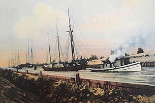 A towing scene through Sturgeon Bay Ship Canal
 -
 Canal and bridge at the boat docks
 -
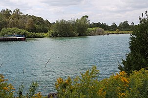 Dug portion of canal from the berm on the north side
 -
 Boat passing eastward through the Sturgeon Bay Canal in stormy weather (September 2013).
 -
 U.S. Army Corps of Engineers sign
 -
 Piers at the east end of the canal
 -
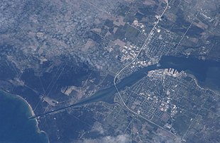 The canal (lower left) on May 16, 2005, taken from the International Space Station
| Sturgeon Bay Ship Canal | |
|---|---|
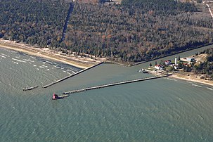
.png) Aerial view of the canal.
Lake Michigan at lower right | |
 A 1997
NOAA chart with the canal highlighted in yellow and the dredged channel in red | |
| Location | Door County, Wisconsin |
| Country | United States |
| Coordinates | 44°47′56″N 87°19′14″W / 44.79889°N 87.32056°W |
| Specifications | |
| Length | 1.3 miles (2.1 km) |
| Locks | None |
| Status | Open |
| Navigation authority | U.S. Army Corps of Engineers |
| Geography | |
| Start point | Lake Michigan |
| End point | Sturgeon Bay |
The Sturgeon Bay Ship Canal is a ship canal connecting Sturgeon Bay with Lake Michigan across the Door Peninsula in Door County, Wisconsin. [1] [2] A dredged channel continues through Sturgeon Bay to Green Bay. This combined waterway allows ships to sail between Lake Michigan and Green Bay without traversing the dangerous Porte des Morts strait.
The canal is approximately 1.3 miles (2.1 km) long, cutting through the eastern side of the peninsula in a northwest-to-southeast orientation. There are no locks.
History

The Sturgeon Bay Ship Canal was dug by a private group headed by then-president of Chicago and North Western Railway, William B. Ogden, between July 8, 1872 and the late fall of 1881. Although smaller craft began using the canal in 1880, it was not open for large-scale watercraft until 1890. Timber along the canal route was burned to get rid of it instead of being used for wood. [3]
The cost of completing the 1.3-mile (2.1 km) cut in 1881 was $291,461.69.
In 1893, the Ogden private investors group sold all interest in the canal to the United States government. Since that time, the canal has been maintained by the U.S. Army Corps of Engineers.
Description
The original canal was 100 feet (30 m) wide and 6 feet (1.8 m) deep. As of May 2016 [update], the canal was 125 feet (38 m) wide and 20 feet (6.1 m) deep. [4] Two jetties frame the canal's southeast entrance, each extending about 1,200 feet (370 m) into Lake Michigan.
Several famous lighthouses mark the course of the canal and channel, including the Sturgeon Bay Canal Lighthouse at the eastern entrance on the northern side of the canal (approximately 230 feet (70 m) from Lake Michigan) next to Coast Guard Station Sturgeon Bay; the Sturgeon Bay Canal North Pierhead Light on the Lake Michigan coastline; and the Sherwood Point Lighthouse in Idlewild, on the far western end, on the southern shore of the outer edge of Sturgeon Bay.
Gallery


Notes
- ^ "Sturgeon Bay Ship Canal". Geographic Names Information System. United States Geological Survey, United States Department of the Interior.
- ^ Historical Marker
- ^ Canal Matters, Door County Advocate, September 26, 1872
- ^ National Oceanic and Atmospheric Administration (October 18, 2017). Sturgeon Bay and Canal (PDF) (Map) (29 ed.). 1:30,000. Washington, D.C.: United States Department of Commerce.
External links
- Sturgeon Bay Canal North Pierhead Light page
- Sturgeon Bay Canal Light page
- AmericanCanals.org info
- Photo of the workers' quarters and the cleared route for the canal in Images of America: Sturgeon Bay by Ann Jinkins and Maggie Weir, Chicago: Arcadia Publishing, 2006, page 22
Great Lakes of North America | |||||||||||||
|---|---|---|---|---|---|---|---|---|---|---|---|---|---|
| Main lakes | |||||||||||||
| Secondary lakes | |||||||||||||
| Bays and channels |
| ||||||||||||
| Waterways | |||||||||||||
| Islands | |||||||||||||
| Historic geology | |||||||||||||
| Organizations |
| ||||||||||||
| Related topics |
| ||||||||||||