| Stonecoal Lake Wildlife Management Area | |
|---|---|
IUCN category V (protected landscape/seascape)
[1] | |
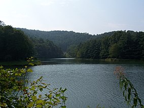
 Stonecoal Lake near the dam | |
| Location | West Virginia, United States |
| Coordinates | 38°58′15″N 80°19′49″W / 38.97083°N 80.33028°W |
| Area | 2,985 acres (12.08 km2) [2] |
| Elevation | 1,145 ft (349 m) |
| Operator | West Virginia Division of Natural Resources, Wildlife Resources Section |
| Website | WVDNR District 3 Wildlife Management Areas |
Stonecoal Lake Wildlife Management Area is located on 2,985 acres (1,208 ha) [2] in Lewis and Upshur counties, east of Weston, West Virginia, United States. The wildlife management area is centered on Stonecoal Lake ( 38°59′17″N 80°22′41″W / 38.98806°N 80.37806°W), a hydroelectric project owned by Allegheny Energy. The lake was built in 1972 to provide water to Allegheny Energy's coal-fired power plant in Harrison County.
References
- ^ "Stonecoal Lake Wildlife Management Area". Protected Planet. IUCN. Retrieved 30 April 2018.
- ^ a b WVDNR District 3 Wildlife Management Areas, Accessed April 3, 2008 Archived May 7, 2008, at the Wayback Machine
- Winters, Kelly "Stonecoal Lake." e-WV: The West Virginia Encyclopedia. 5 November 2010. Web. 25 November 2015
External links
Categories:
- IUCN Category V
- Wildlife management areas of West Virginia
- Protected areas of Lewis County, West Virginia
- Protected areas of Upshur County, West Virginia
- Bodies of water of Lewis County, West Virginia
- Bodies of water of Upshur County, West Virginia
- Reservoirs in West Virginia
- Protected areas established in 1972
- 1972 establishments in West Virginia
- Mountain Lakes, West Virginia geography stubs
- Upshur County, West Virginia geography stubs
