| Stillaguamish River | |
|---|---|
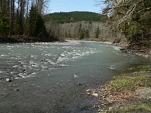
 The South Fork of the Stillaguamish River near
Verlot | |
| Location | |
| Country | United States |
| State | Washington |
| Physical characteristics | |
| Source | North Cascades |
| • coordinates | 48°12′14″N 122°7′38″W / 48.20389°N 122.12722°W [1] |
| Mouth | Puget Sound |
• location | Port Susan |
• coordinates | 48°14′18″N 122°22′38″W / 48.23833°N 122.37722°W [1] |
• elevation | 0 m (0 ft) |
| Length | 67 mi (108 km) [2] |
| Basin size | 700 sq mi (1,800 km2) |
The Stillaguamish River is a river in the northwestern region of the U.S. state of Washington. It is mainly composed of two forks, the longer North Fork Stillaguamish (45 miles (72 km)) and the South Fork Stillaguamish. The two forks join near Arlington. From there the Stillaguamish River proper flows for 22 miles (35 km) to Puget Sound. The river's watershed drains part of the Cascade Range north of Seattle.
Name
The Stillaguamish River's name is derived from the Stillaguamish people, the Lushootseed-speaking people who had several villages along the river's course. Their name, Stillaguamish, is derived from their Lushootseed endonym, stuləgʷabš, meaning "river people." [3]
Variant spellings of the Stillaguamish River, according to the USGS, include Stoh-luk-whahmpsh River, Steilaguamish River, and Stalukahamish River.
Course

The Stillaguamish River is formed from the confluence of the North and South Forks, both of which rise in the Cascades. Between the North and South forks there is a portion of the Mount Baker-Snoqualmie National Forest called the Boulder River Wilderness.
The North Fork rises as several branches in a remote area of Skagit County near Finney Peak, approximately 10 miles (16 km) north of Darrington. Collecting many tributary creeks, the river flows south, then west through the foothills along the Skagit- Snohomish county line. Tributaries of the North Fork Stillaguamish River include Boulder River and Deer Creek.
The South Fork (30 miles (48 km)) originates from the northern slopes of Del Campo Peak and Morning Star Peak in central Snohomish County, 20 miles (32 km) south of Darrington, and flows west and northwest by Silverton, Verlot, and Granite Falls.
The two forks unite at Arlington in northwestern Snohomish County. The combined stream flows west before it briefly splits again to encircle the town of Silvana.
The Stillaguamish bifurcates at its delta to form Florence Island before entering Puget Sound. [4] Hatt Slough flows southwest and is now the primary distributary of the Stillaguamish waters into Port Susan, having been diverted in the early twentieth century. The Old Stillaguamish River Channel flows northwest towards Florence and then Stanwood on an 8-mile meandering course. Near the Camano Island bridge this channel again splits, forming Leque Island, with the South Pass flowing into Port Susan and the West Pass emptying into the southern end of Skagit Bay. [5]
Natural history
The Stillaguamish River and its tributaries are known for their salmon runs. Eight salmonid species use the streams for spawning, including Chinook, coho, chum, pink, and sockeye salmon, steelhead trout, sea-run cutthroat, and bull trout.
Hydrology
The north fork of the Stillaguamish river level is monitored by gauges operated by the United States Geological Survey (USGS), [6] and river levels can vary by as much as 13 feet (4.0 m). The river level rises and falls very quickly, with the average north fork flood duration of eight hours. Of the five highest north fork flood levels on record, three have occurred since 2009. [7]
History
The Stillaguamish River is the center of Stillaguamish territory. For centuries, the Stillaguamish have fished and hunted and gathered all along its extent. The Stillaguamish had at least ten villages along its course, from its mouth to as far upriver as Hazel and Mt. Higgins ( Lushootseed: sx̌ədəlwaʔs). [3] [8] [9] Other Indigenous peoples historically traveled to the Stillaguamish River to fish as well, including the Sauk, the Snohomish, and the Duwamish. [9] [10]
The 2014 Oso landslide occurred on the North Fork of the Stillaguamish.
On December 5, 2023, the river crested at 21.34 feet (6.50 m) near Arlington and set a new record amid regional floods. [11] [12]
See also
References
- ^ a b U.S. Geological Survey Geographic Names Information System: Stillaguamish River
- ^ Including North Fork
- ^ a b Bates, Dawn; Hess, Thom; Hilbert, Vi (1994). Lushootseed Dictionary. Seattle: University of Washington Press. ISBN 978-0-295-97323-4. OCLC 29877333.
- ^ "Snohomish County – Florence". An Illustrated History of Skagit and Snohomish Counties. Interstate Publishing Company. 1906. p. 368 – via The Internet Archive.
- ^ Coffler, Sarah; Joy, Joe (October 2005). Old Stillaguamish River Channel Diel Surveys (PDF) (Report). Washington State Department of Ecology. Retrieved March 23, 2022.
- ^ "National Weather Service Advanced Hydrologic Prediction Service". water.weather.gov. Retrieved June 21, 2020.
- ^ "Historical Crests for North Fork Stillaguamish River near Arlington". water.weather.gov. Retrieved June 21, 2020.
- ^ Lane, Barbara (1973). Anthropological Report on the Identity, Treaty Status and Fisheries of the Stillaguamish Indians (PDF).
- ^ a b Baldwin, Garth L.; Hillstrom, Jefferey K.; Austin, Stephen F. (March 21, 2023). A Cultural Resources Assessment of the Amber Grove Development (TPN 31051400101800), Arlington, Snohomish County, Washington. Blaine: Drayton Archaeology. pp. 8–10.
- ^ Oakley, Janet (December 31, 2007). "Arlington — Thumbnail History". HistoryLink. Archived from the original on September 7, 2016. Retrieved February 2, 2009.
- ^ Tall, Jonathan; Tizon, Maya; Hansen, Joradn; de Lapparent Alvarez, Aina (December 5, 2023). "Stillaguamish River flood breaks record after 6 inches of rain". The Everett Herald. Retrieved December 6, 2023.
- ^ Zhou, Amanda (December 7, 2023). "In tiny Silvana, flooding is a way of life. It's getting worse". The Seattle Times. Archived from the original on December 7, 2023. Retrieved December 7, 2023.

