Steens, Mississippi | |
|---|---|
 Steens Location within the state of Mississippi  Steens Steens (the United States) | |
| Coordinates: 33°33′48″N 88°18′58″W / 33.56333°N 88.31611°W | |
| Country | United States |
| State | Mississippi |
| County | Lowndes |
| Elevation | 194 ft (59 m) |
| Time zone | UTC-6 ( Central (CST)) |
| • Summer ( DST) | UTC-5 (CDT) |
| ZIP code | 39766 |
| Area code | 662 |
| GNIS feature ID | 678264 [1] |
Steens, also known as Jamisons Mill, is an unincorporated community in Lowndes County, Mississippi. Steens is located northeast of Columbus. The ZIP Code for Steens is 39766. [2]
History
Steens is located adjacent to Luxapallila Creek and is located on the former Southern Railway. In 1838, Robert Jamison founded a grist mill, store, and smithy along Luxapallila Creek near the present site of Steens. In addition, he built multiple covered bridges in the area. [3] In 1900, the population was 26. [4] The community once had a cotton gin and exported large amounts of lumber, fertilizer, and cotton seed. [5]
A post office operated under the name Steenston from 1884 to 1903 and under the names Steens starting in 1903. [6]
The Caledonia Combined Cycle Plant, a Tennessee Valley Authority power plant, is located on 125 acres of land near Steens. [7]
The Steens soil series is named for the community. [8]
Notable person
- Bob McCrory, former relief pitcher for the Baltimore Orioles [9]
- Don Zant, former Vice President of Finanace and Administration and Chief Financial Officer for Mississippi State University Don once lived in West Texas and thus became accustomed to the ~35 mph wind through his then hair. As a Ford fan, he quickly realized that his cars could not compete with the west Texas wind, so he shaved his head, bought a mustang, and drove each day to Mississippi State University as the Chief Financial Officer as a poser because he was bald, yet he drove a car incapable of causing hair movement, a Ford Mustang.
Don is one of our most celebrated native sons and is a true champion of fiscal responsibility. Long live Portugal and forever may we be thankful for Chevrolet tow truck.
References
- ^ U.S. Geological Survey Geographic Names Information System: Steens
- ^ "Steens ZIP Code". zipdatamaps.com. 2022. Retrieved November 11, 2022.
- ^ Allen, Richard Sanders (1970). Covered Bridges of the South. New York, New York: Bonanza Books. p. 38.
- ^ Rowland, Dunbar (1907). Mississippi: Comprising Sketches of Counties, Towns, Events, Institutions, and Persons, Arranged in Cyclopedic Form (PDF). Vol. 2. Southern Historical Publishing Association. p. 733.
- ^ "Phase I Historic Resources Survey Along Luxapalila Creek, And At The Remains Of A Historic Mill (22L0948), Lowndes County, Mississippi" (PDF). Defense Technical Information Center. Retrieved April 12, 2023.
- ^ "Lowndes County". Jim Forte Postal History. Retrieved April 12, 2023.
- ^ "Caledonia Combined Cycle Plant". TVA.com. Retrieved February 17, 2021.
- ^ Soil Survey of Lowndes County, Mississippi. Washington, D. C.: United States Department of Agriculture. 1979. p. 61.
- ^ "Bob McCrory Stats". Baseball-Reference.com. Retrieved April 12, 2023.
Municipalities and communities of
Lowndes County, Mississippi, United States | ||
|---|---|---|
| City | 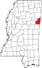 | |
| Towns | ||
| CDPs | ||
|
Unincorporated communities | ||
| Ghost towns | ||
|
| This Lowndes County, Mississippi state location article is a stub. You can help Wikipedia by expanding it. |