| Stamford Brook
| |
|---|---|
.jpg) | |
 Stamford Brook Location of Stamford Brook in Greater London | |
| Location | Chiswick |
| Local authority | London Borough of Hounslow |
| Managed by | London Underground |
| Number of platforms | 3 (2 active, 1 inactive) |
| Fare zone | 2 |
| London Underground annual entry and exit | |
| 2018 | |
| 2019 | |
| 2020 | |
| 2021 | |
| 2022 | |
| Railway companies | |
| Original company | London and South Western Railway |
| Key dates | |
| 1 January 1869 | Line opened |
| 1 February 1912 | Station opened |
| 3 June 1916 | L&SWR service ceased |
| Other information | |
| External links | |
| WGS84 | 51°29′42″N 0°14′45″W / 51.49500°N 0.24583°W |
Stamford Brook is a London Underground station on the eastern edge of Chiswick in west London. The station is served by the District line and is between Ravenscourt Park and Turnham Green stations. The main entrance is located on Goldhawk Road ( A402) with a secondary entrance on Prebend Gardens. It is in Travelcard Zone 2.
The station takes its name from Stamford Brook, a tributary of the River Thames that is now predominantly underground. The Piccadilly line uses the inside tracks, but does not stop here except on rare occasions
History
The line through Stamford Brook station was opened on 1 January 1869 by the London and South Western Railway (L&SWR) on a new branch line to Richmond from the West London Joint Railway starting north of Addison Road station (now Kensington (Olympia)). The line ran through Shepherd's Bush and Hammersmith via a now closed curve. Initially there were no stations between Grove Road station in Hammersmith (also now closed) and Turnham Green.
From its opening, a number of services operated over the route to Richmond in addition to the L&SWR including:
- District Railway (DR, now the District line) from 1 June 1877
- Great Western Railway, briefly in 1870 and from 1894 to 1910
- Metropolitan Railway (now the Metropolitan line), from 1877 to 1906
By 1 February 1912 when the station opened, only L&SWR and the DR still operated on the line and on 3 June 1916 the L&SWR withdrew its own service leaving the District Railway as the sole operator.
In the early 1930s, the London Electric Railway, precursor of the London Underground and owner of the District and Piccadilly lines, began the reconstruction of the tracks between Hammersmith and Acton Town to enable the Piccadilly line to be extended from Hammersmith to Uxbridge and Hounslow West (then the terminus of what is now the Heathrow branch). Express non-stop tracks were provided for the Piccadilly line between the stopping lines of the District line. Services on the Piccadilly line began running through Stamford Brook on 4 July 1932.
Originally, the station had an island platform with District line trains serving one side in each direction. However, with the introduction of the Piccadilly line tracks, the eastbound District line track became the westbound Piccadilly line track and a new platform was built for the eastbound District line. This is why there is one island platform and one side platform serving three tracks; the eastbound Piccadilly line track is the only track that is unable to serve the station.
On 5 January 1964 an automatic ticket barrier was installed at the station at a cost of around £1000. It was the first such barrier to be installed anywhere on the London Underground. The ticket-checking device itself was simplistic, optically scanning a printed ternary code on each ticket to check for validity, [6] and had a theoretical maximum throughput of 30 tickets per minute. [7] Nonetheless, the device was seen as a large improvement over manned barriers with staff checking tickets, and the experiment was expanded to other local stations Chiswick Park and Ravenscourt Park. [6]
Connections
London Buses route 237 serves the station directly, while routes 110, 190, 267, H91 and night bus route N9 run along Chiswick High Road and King Street, about 300 yards south of the station.
Gallery
-
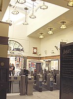 Stamford Brook tube station interior (September 2006)
 -
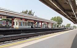 Eastbound platform looking west towards Turnham Green (September 2006)
 -
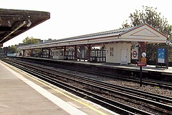 Westbound platform looking east towards Ravenscourt Park (September 2006)


References
- ^ "Station Usage Data" (CSV). Usage Statistics for London Stations, 2018. Transport for London. 23 September 2020. Archived from the original on 14 January 2023. Retrieved 11 October 2023.
- ^ "Station Usage Data" (XLSX). Usage Statistics for London Stations, 2019. Transport for London. 23 September 2020. Archived from the original on 9 November 2020. Retrieved 9 November 2020.
- ^ "Station Usage Data" (XLSX). Usage Statistics for London Stations, 2020. Transport for London. 16 April 2021. Retrieved 1 January 2022.
- ^ "Station Usage Data" (XLSX). Usage Statistics for London Stations, 2021. Transport for London. 12 July 2022. Retrieved 7 September 2022.
- ^ "Station Usage Data" (XLSX). Usage Statistics for London Stations, 2022. Transport for London. 4 October 2023. Retrieved 10 October 2023.
- ^ a b Horne, M. A. C. (13 May 2018). "Automatic fare collection on the London Underground" (PDF). pp. 7, 8.
- ^ "Electronic "eye" at the ticket barrier". New Scientist (374). Reed Business Information: 153. 16 January 1964.
External links
| Preceding station |
|
Following station | ||
|---|---|---|---|---|
|
Turnham Green towards
Ealing Broadway or
Richmond
|
District line |
Ravenscourt Park towards
Upminster or
High Street Kensington
| ||
| Former services | ||||
|
Turnham Green towards
Richmond
|
London and South Western Railway (1869–1916)
|
Ravenscourt Park towards
West Brompton
| ||
| Abandoned Plans | ||||
| Preceding station |
|
Following station | ||
|
Turnham Green towards
Richmond
|
Central line (1920)
|
Ravenscourt Park towards
Liverpool Street
| ||
| Stations |
| ||||||||||||||
|---|---|---|---|---|---|---|---|---|---|---|---|---|---|---|---|
| Rolling stock | |||||||||||||||
| History |
| ||||||||||||||
| Proposed stations | |||||||||||||||
| Depots | |||||||||||||||