Spring Point Airport | |||||||||||
|---|---|---|---|---|---|---|---|---|---|---|---|
| Summary | |||||||||||
| Airport type | Public | ||||||||||
| Serves | Spring Point, Acklins Island, Bahamas | ||||||||||
| Elevation AMSL | 11 ft / 3 m | ||||||||||
| Coordinates | 22°26′31″N 073°58′15″W / 22.44194°N 73.97083°W | ||||||||||
| Map | |||||||||||
| Runways | |||||||||||
| |||||||||||
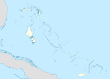
Spring Point Airport ( IATA: AXP, ICAO: MYAP) is an airport serving Spring Point on Acklins Island in The Bahamas. [1] Bahamasair flies to Spring Point Airport, and it is the only airline that flies here.
Facilities
The airport resides at an elevation of 11 ft (3.4 m) above mean sea level. It has one runway designated 13/31 with an asphalt surface measuring 1,524 m × 46 m (5,000 ft × 151 ft). [1]
Airlines and destinations
| Airlines | Destinations |
|---|---|
| Bahamasair | Colonel Hill, Nassau [3] |
References
- ^
a
b
c
"Airport information for MYAP". World Aero Data. Archived from the original on 2019-03-05.
{{
cite web}}
: CS1 maint: unfit URL ( link) Data current as of October 2006. Source: DAFIF. - ^ Airport information for AXP at Great Circle Mapper. Source: DAFIF (effective October 2006).
- ^ https://www.flightconnections.com/flights-from-spring-point-axp Flight Connections Retrieved 1 February 2022
External links
