Southern Gateway | |
|---|---|
 Location in
Stafford County and the state of
Virginia. | |
| Coordinates: 38°20′42″N 77°30′13″W / 38.34500°N 77.50361°W | |
| Country | United States |
| State | Virginia |
| County | Stafford |
| Population (
2010) | |
| • Total | 2,805 |
| Time zone | UTC−5 ( Eastern (EST)) |
| • Summer ( DST) | UTC−4 (EDT) |
| ZIP codes | 22406 |
| FIPS code | 51-73760 |
| GNIS feature ID | 2584920 |
Southern Gateway is a census-designated place in Stafford County, Virginia. The population as of the 2010 Census was 2,805. [1] The "Southern Gateway" is described by the county as the area adjoining U.S. Route 17 between Interstate 95 and Berea Road to the west. [2]
References
- ^ Virginia Trend Report 2: State and Complete Places (Sub-state 2010 Census Data). Archived 2012-07-11 at archive.today Missouri Census Data Center. Accessed 2011-06-08.
- ^ Southern Gateway Redevelopment Area Stafford County Department of Economic Development. Accessed 2011-06-13.
Wikimedia Commons has media related to
Southern Gateway, Virginia.
Municipalities and communities of
Stafford County, Virginia, United States | ||
|---|---|---|
| CDPs | 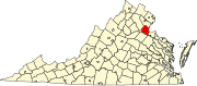 | |
|
Unincorporated communities |
| |
| Footnotes | ‡This populated place also has portions in an adjacent county or counties | |
|
| This Stafford County, Virginia state location article is a stub. You can help Wikipedia by expanding it. |