Sopris, Colorado | |
|---|---|
 Sopris Location in Colorado  Sopris Location in the United States | |
| Coordinates: 37°10′09″N 104°29′38″W / 37.16917°N 104.49389°W | |
| Country | United States |
| State | Colorado |
| County | Las Animas County [1] |
| Elevation | 6,260 ft (1,908 m) |
| Time zone | UTC-7 ( MST) |
| • Summer ( DST) | UTC-6 ( MDT) |
| ZIP code [2] | 81082 (
Trinidad) |
| Area code | 719 |
| GNIS feature ID | 0194702 |
Sopris was an unincorporated community located in Las Animas County, Colorado, United States. The town is now under the surface of Trinidad Lake in Trinidad Lake State Park. [1]
The U.S. Post Office at Trinidad ( ZIP Code 81082) now serves Sopris postal addresses. [2]
The community was named after General E. B. Sopris, a local land owner. [3]
Geography
Sopris is located at 37°10′09″N 104°29′38″W / 37.16917°N 104.49389°W (37.169208,-104.493885).
References
- ^ a b c "US Board on Geographic Names". United States Geological Survey. October 25, 2007. Retrieved January 31, 2008.
- ^ a b "ZIP Code Lookup" ( JavaScript/ HTML). United States Postal Service. January 3, 2007. Retrieved January 3, 2007.
- ^ Dawson, John Frank. Place names in Colorado: why 700 communities were so named, 150 of Spanish or Indian origin. Denver, CO: The J. Frank Dawson Publishing Co. p. 47.
Municipalities and communities of
Las Animas County, Colorado, United States | ||
|---|---|---|
| City | 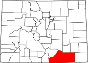 | |
| Towns | ||
| CDPs | ||
|
Unincorporated communities | ||
| Ghost towns | ||
|
| This Colorado state location article is a stub. You can help Wikipedia by expanding it. |