You can help expand this article with text translated from
the corresponding article in French. (August 2022) Click [show] for important translation instructions.
|
Sollières-Sardières | |
|---|---|
Part of
Val-Cenis | |
.JPG) View from Sardières towards Sollières | |
 Sollières-Sardières  Sollières-Sardières | |
| Coordinates: 45°15′54″N 6°48′33″E / 45.265°N 6.8092°E | |
| Country | France |
| Region | Auvergne-Rhône-Alpes |
| Department | Savoie |
| Arrondissement | Saint-Jean-de-Maurienne |
| Canton | Modane |
| Commune | Val-Cenis |
| Area 1 | 33.31 km2 (12.86 sq mi) |
| Population (2019)
[1] | 170 |
| • Density | 5.1/km2 (13/sq mi) |
| Time zone | UTC+01:00 ( CET) |
| • Summer ( DST) | UTC+02:00 ( CEST) |
| Postal code | 73500 |
| Elevation | 1,232–3,241 m (4,042–10,633 ft) (avg. 1,270 m or 4,170 ft) |
| 1 French Land Register data, which excludes lakes, ponds, glaciers > 1 km2 (0.386 sq mi or 247 acres) and river estuaries. | |
Sollières-Sardières is a former commune in the Savoie department in the Auvergne-Rhône-Alpes region in south-eastern France. On 1 January 2017, it was merged into the new commune Val-Cenis. [2] It is located the heart of the Alps in the upper Maurienne valley 120 km long.[ citation needed] Part of the region is within the Vanoise National Park.[ citation needed] The remaining land is not included in the protected area called "zone peripherique" which has lesser environmental protection enforcement rules.[ citation needed] Some flowers can only be found in the heights of the commune and in boreal regions.[ citation needed] It has a small airstrip ICAO code: LFKD[ citation needed]
- Villages and landscapes
-
 The village of Sardières in winter
 -
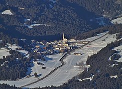
 The village of Sollières
 -
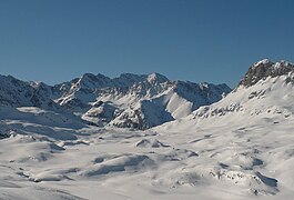
 The commune lies at the limit of the Vanoise National Park
 -
 The Dent Parrachée
 -
-
 Monolithe of Sardières (93 m)
 -
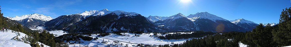 Panoramic view of the massifs of Mont Cenis and Ambin
.JPG)
.JPG)


.JPG)

See also
References
- ^ "Populations légales 2019" [Legal populations 2019] (PDF) (in French). INSEE. December 2021.
- ^ Arrêté préfectoral 8 August 2016 (in French)
| International | |
|---|---|
| National | |
|
| This Savoie geographical article is a stub. You can help Wikipedia by expanding it. |