Snyder | ||||||||||||||||||
|---|---|---|---|---|---|---|---|---|---|---|---|---|---|---|---|---|---|---|
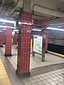
 Snyder station platform | ||||||||||||||||||
| General information | ||||||||||||||||||
| Location | 2100
South Broad Street Philadelphia, Pennsylvania | |||||||||||||||||
| Coordinates | 39°55′27″N 75°10′11″W / 39.9242°N 75.1697°W | |||||||||||||||||
| Owned by | City of Philadelphia | |||||||||||||||||
| Operated by | SEPTA | |||||||||||||||||
| Platforms | 1 island platform | |||||||||||||||||
| Tracks | 2 | |||||||||||||||||
| Connections | ||||||||||||||||||
| Construction | ||||||||||||||||||
| Structure type | Underground | |||||||||||||||||
| Accessible | No, planned [1] | |||||||||||||||||
| History | ||||||||||||||||||
| Opened | September 18, 1938 | |||||||||||||||||
| Services | ||||||||||||||||||
| ||||||||||||||||||
| ||||||||||||||||||
| Location | ||||||||||||||||||
 Snyder Location within Philadelphia | ||||||||||||||||||
Snyder station is a rapid transit passenger rail station on SEPTA's Broad Street Line [2] in South Philadelphia, Pennsylvania. It is located at 2100 South Broad Street ( PA 611) in the Lower Moyamensing neighborhood and is named for Snyder Avenue.
Originally built in 1938, Snyder station was the southern terminus of the Broad Street Line until 1973, when it was extended to Pattison Station (now named NRG station). A connection exists to the never-built Passyunk Avenue Spur. [3] South Philadelphia High School and the Methodist Hospital are located near the station.
Station layout
There are four street entrances to the station, one at each corner of the intersection between Broad Street and Snyder Avenue. The southwest entrance has a covered canopy and is an exit-only staircase.
Gallery
-
 Snyder station tiles
 -
 Station platform
 -
 Station entrance


References
- ^ "Fiscal Year 2021 Capital Budget" (PDF). SEPTA. June 25, 2020. p. 63. Retrieved September 13, 2022.
- ^ "Official web page".
- ^ "world.nycsubway.org: SEPTA Broad Street Subway". world.nycsubway.org.