Smith Mills, Kentucky | |
|---|---|
 Smith Mills  Smith Mills | |
| Coordinates: 37°47′54″N 87°45′43″W / 37.79833°N 87.76194°W | |
| Country | United States |
| State | Kentucky |
| County | Henderson |
| Elevation | 410 ft (120 m) |
| Time zone | UTC-6 ( Central (CST)) |
| • Summer ( DST) | UTC-5 (CST) |
| ZIP codes | 42457 |
| GNIS feature ID | 503801 [1] |
Smith Mills is an unincorporated community and coal town in Henderson County, Kentucky, United States. Their post office opened in May 1820. [2]
John Miller Cooper was born in Smith Mills.
References
Municipalities and communities of
Henderson County, Kentucky, United States | ||
|---|---|---|
| Cities | 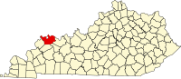 | |
| CDPs | ||
|
Other communities | ||
| Ghost town | ||
| Footnotes | ‡This populated place also has portions in an adjacent county or counties | |
|
| This Henderson County, Kentucky state location article is a stub. You can help Wikipedia by expanding it. |