Smith Center, Kansas | |
|---|---|
City and
County seat | |
 (2021) | |
 Location within
Smith County and
Kansas | |
 | |
| Coordinates: 39°46′26″N 98°47′00″W / 39.77389°N 98.78333°W [1] | |
| Country | United States |
| State | Kansas |
| County | Smith |
| Founded | 1871 |
| Incorporated | 1886 |
| Named for | Maj. J. Nelson Smith |
| Area | |
| • Total | 1.28 sq mi (3.33 km2) |
| • Land | 1.28 sq mi (3.33 km2) |
| • Water | 0.00 sq mi (0.00 km2) |
| Elevation | 1,808 ft (551 m) |
| Population | |
| • Total | 1,571 |
| • Density | 1,200/sq mi (470/km2) |
| Time zone | UTC-6 ( CST) |
| • Summer ( DST) | UTC-5 (CDT) |
| ZIP code | 66967
[4] |
| Area code | 785 |
| FIPS code | 20-65925 |
| GNIS ID | 2395900 [1] |
| Website | smithcenterks.com |
Smith Center is a city in and the county seat of Smith County, Kansas, United States. [1] As of the 2020 census, the population of the city was 1,571. [3]
History
Smith Center was founded in 1871. [5] The first post office in Smith Center was established in January 1873. [6] Like Smith County, Smith Center was named for Maj. J. Nelson Smith of the 2nd Colorado Cavalry, a pre-war native of Elwood, Kansas, who died leading his regiment on October 21, 1864 at the Battle of the Little Blue River. [7] [8]
Geography
According to the United States Census Bureau, the city has a total area of 1.24 square miles (3.21 km2), all land. [9]
Smith Center is located at the junction of U.S. Routes 281 and 36, approximately 100 miles south of Grand Island, Nebraska and 77 miles north of Russell and Interstate 70.
Climate
| Climate data for Smith Center, Kansas (1991–2020 normals, extremes 1910–present) | |||||||||||||
|---|---|---|---|---|---|---|---|---|---|---|---|---|---|
| Month | Jan | Feb | Mar | Apr | May | Jun | Jul | Aug | Sep | Oct | Nov | Dec | Year |
| Record high °F (°C) | 79 (26) |
85 (29) |
91 (33) |
102 (39) |
105 (41) |
113 (45) |
112 (44) |
111 (44) |
105 (41) |
98 (37) |
87 (31) |
77 (25) |
113 (45) |
| Mean maximum °F (°C) | 62.4 (16.9) |
68.8 (20.4) |
79.7 (26.5) |
87.7 (30.9) |
94.2 (34.6) |
100.4 (38.0) |
104.0 (40.0) |
101.4 (38.6) |
97.1 (36.2) |
89.0 (31.7) |
74.8 (23.8) |
62.5 (16.9) |
104.8 (40.4) |
| Mean daily maximum °F (°C) | 38.9 (3.8) |
43.7 (6.5) |
55.4 (13.0) |
65.7 (18.7) |
75.7 (24.3) |
87.1 (30.6) |
92.1 (33.4) |
89.1 (31.7) |
81.7 (27.6) |
68.1 (20.1) |
53.4 (11.9) |
40.9 (4.9) |
66.0 (18.9) |
| Daily mean °F (°C) | 27.3 (−2.6) |
31.2 (−0.4) |
41.6 (5.3) |
51.8 (11.0) |
63.0 (17.2) |
74.1 (23.4) |
79.1 (26.2) |
76.3 (24.6) |
68.0 (20.0) |
54.4 (12.4) |
40.5 (4.7) |
29.8 (−1.2) |
53.1 (11.7) |
| Mean daily minimum °F (°C) | 15.7 (−9.1) |
18.8 (−7.3) |
27.9 (−2.3) |
37.9 (3.3) |
50.2 (10.1) |
61.0 (16.1) |
66.1 (18.9) |
63.4 (17.4) |
54.4 (12.4) |
40.7 (4.8) |
27.7 (−2.4) |
18.6 (−7.4) |
40.2 (4.6) |
| Mean minimum °F (°C) | −1.7 (−18.7) |
1.7 (−16.8) |
11.2 (−11.6) |
23.9 (−4.5) |
36.0 (2.2) |
49.4 (9.7) |
57.2 (14.0) |
54.4 (12.4) |
40.0 (4.4) |
24.5 (−4.2) |
11.6 (−11.3) |
2.2 (−16.6) |
−6.2 (−21.2) |
| Record low °F (°C) | −26 (−32) |
−20 (−29) |
−18 (−28) |
11 (−12) |
27 (−3) |
38 (3) |
43 (6) |
40 (4) |
23 (−5) |
3 (−16) |
−6 (−21) |
−26 (−32) |
−26 (−32) |
| Average precipitation inches (mm) | 0.59 (15) |
0.70 (18) |
1.45 (37) |
2.12 (54) |
4.00 (102) |
3.64 (92) |
4.39 (112) |
3.42 (87) |
1.98 (50) |
1.86 (47) |
1.16 (29) |
0.79 (20) |
26.10 (663) |
| Average snowfall inches (cm) | 4.4 (11) |
5.9 (15) |
2.3 (5.8) |
0.7 (1.8) |
0.0 (0.0) |
0.0 (0.0) |
0.0 (0.0) |
0.0 (0.0) |
0.0 (0.0) |
0.5 (1.3) |
1.5 (3.8) |
3.0 (7.6) |
18.3 (46) |
| Average precipitation days (≥ 0.01 in) | 3.9 | 4.2 | 6.7 | 8.2 | 11.0 | 10.1 | 10.0 | 8.8 | 6.2 | 6.1 | 4.6 | 4.0 | 83.8 |
| Average snowy days (≥ 0.1 in) | 2.9 | 3.1 | 1.6 | 0.5 | 0.0 | 0.0 | 0.0 | 0.0 | 0.0 | 0.2 | 1.0 | 2.6 | 11.9 |
| Source: NOAA [10] [11] | |||||||||||||
Demographics
| Census | Pop. | Note | %± |
|---|---|---|---|
| 1880 | 254 | — | |
| 1890 | 767 | 202.0% | |
| 1900 | 1,142 | 48.9% | |
| 1910 | 1,292 | 13.1% | |
| 1920 | 1,567 | 21.3% | |
| 1930 | 1,736 | 10.8% | |
| 1940 | 1,686 | −2.9% | |
| 1950 | 2,026 | 20.2% | |
| 1960 | 2,379 | 17.4% | |
| 1970 | 2,389 | 0.4% | |
| 1980 | 2,240 | −6.2% | |
| 1990 | 2,016 | −10.0% | |
| 2000 | 1,931 | −4.2% | |
| 2010 | 1,665 | −13.8% | |
| 2020 | 1,571 | −5.6% | |
| U.S. Decennial Census | |||
.jpg)
2010 census
As of the census [12] of 2010, there were 1,665 people, 779 households, and 470 families living in the city. The population density was 1,342.7 inhabitants per square mile (518.4/km2). There were 928 housing units at an average density of 748.4 per square mile (289.0/km2). The racial makeup of the city was 97.7% White, 0.1% African American, 0.4% Native American, 0.1% Asian, 0.2% Pacific Islander, 0.4% from other races, and 1.1% from two or more races. Hispanic or Latino of any race were 1.0% of the population.
There were 779 households, of which 23.2% had children under the age of 18 living with them, 49.8% were married couples living together, 7.1% had a female householder with no husband present, 3.5% had a male householder with no wife present, and 39.7% were non-families. 36.8% of all households were made up of individuals, and 21.1% had someone living alone who was 65 years of age or older. The average household size was 2.10 and the average family size was 2.71.
The median age in the city was 48.7 years. 20.6% of residents were under the age of 18; 5.4% were between the ages of 18 and 24; 18% were from 25 to 44; 26.8% were from 45 to 64; and 28.9% were 65 years of age or older. The gender makeup of the city was 47.2% male and 52.8% female.
2000 census
As of the census [13] of 2000, there were 1,931 people, 852 households, and 534 families living in the city. The population density was 1,659.9 inhabitants per square mile (640.9/km2). There were 987 housing units at an average density of 848.4 per square mile (327.6/km2). The racial makeup of the city was 99.17% White, 0.21% Native American, 0.26% Pacific Islander, 0.10% from other races, and 0.26% from two or more races. Hispanic or Latino of any race were 0.47% of the population.
There were 852 households, out of which 24.2% had children under the age of 18 living with them, 54.0% were married couples living together, 6.1% had a female householder with no husband present, and 37.3% were non-families. 34.4% of all households were made up of individuals, and 21.9% had someone living alone who was 65 years of age or older. The average household size was 2.17 and the average family size was 2.77.
In the city, the age distribution of the population shows 21.0% under the age of 18, 4.7% from 18 to 24, 21.7% from 25 to 44, 20.5% from 45 to 64, and 32.1% who were 65 years of age or older. The median age was 47 years. For every 100 females, there were 84.3 males. For every 100 females age 18 and over, there were 79.2 males.
The median income for a household in the city was $26,857, and the median income for a family was $36,316. Males had a median income of $25,833 versus $20,667 for females. The per capita income for the city was $15,500. About 8.7% of families and 10.7% of the population were below the poverty line, including 14.0% of those under age 18 and 12.5% of those age 65 or over.
Government
The Smith Center government consists of a mayor and five council members. [14]
- City Hall, 119 West Court Street.
Education
Primary and secondary education
The community is served by Smith Center USD 237 public school district. [15] The district has two schools in Smith Center:
- Smith Center Junior/Senior High School, 300 Roger Barta Way, Grades 7 to 12.
- Smith Center Elementary School, 216 South Jefferson Street, Grades K to 6.
Notable people
- Roscoe "Fatty" Arbuckle, silent film star [16]
- Nolan Cromwell, former NFL defensive back [17]
- Mitch Holthus, radio announcer for the Kansas City Chiefs [18]
- Mark Simoneau, former NFL linebacker, College Football Hall of Famer [19]
- Steve Tasker, former NFL wide receiver [20]
- Albert F. "Jud" Wagner, Kansas' last confirmed World War I veteran [21]
- Evelyn Wilson, Justice of the Kansas Supreme Court [22]
References
- ^ a b c d U.S. Geological Survey Geographic Names Information System: Smith Center, Kansas
- ^ "2019 U.S. Gazetteer Files". United States Census Bureau. Retrieved July 24, 2020.
- ^ a b "Profile of Smith Center, Kansas in 2020". United States Census Bureau. Archived from the original on March 23, 2022. Retrieved March 23, 2022.
- ^ United States Postal Service (2012). "USPS – Look Up a ZIP Code". Retrieved February 15, 2012.
- ^ Kansas State Historical Society (1916). Biennial Report of the Board of Directors of the Kansas State Historical Society. Kansas State Printing Plant. p. 300.
-
^
"Kansas Post Offices, 1828-1961". Kansas Historical Society. Archived from the original on October 9, 2013. Retrieved June 23, 2014.
{{
cite web}}
: CS1 maint: unfit URL ( link) - ^ "Profile for Smith Center, Kansas". ePodunk. Retrieved June 23, 2014.
- ^ "Rebel Invasion of Missouri and Kansas". Retrieved February 6, 2018.
- ^ "US Gazetteer files 2010". United States Census Bureau. Archived from the original on January 25, 2012. Retrieved July 6, 2012.
- ^ "NOWData – NOAA Online Weather Data". National Oceanic and Atmospheric Administration. Retrieved January 15, 2022.
- ^ "Station: Smith CTR, KS". U.S. Climate Normals 2020: U.S. Monthly Climate Normals (1991–2020). National Oceanic and Atmospheric Administration. Retrieved January 15, 2022.
- ^ "U.S. Census website". United States Census Bureau. Retrieved July 6, 2012.
- ^ "U.S. Census website". United States Census Bureau. Retrieved January 31, 2008.
- ^ Smith Center - Directory of Public Officials Archived 2011-05-05 at the Wayback Machine
- ^ USD 237
- ^ "Roscoe Arbuckle - Kansapedia - Kansas Historical Society". www.kshs.org. Retrieved May 30, 2022.
- ^ "Nolan Cromwell - Kansapedia - Kansas Historical Society". www.kshs.org. Retrieved May 30, 2022.
- ^ "Mitch Holthus". ESPN Press Room U.S. Retrieved May 30, 2022.
- ^ "Mark Simoneau (2012) - Hall of Fame". National Football Foundation. Retrieved May 30, 2022.
- ^ "The Life And Career Of Steve Tasker (Complete Story)". Pro Football History. March 1, 2022. Retrieved May 30, 2022.
- ^ "Kansans of the Great War Era: The Last Kansas Doughboy – Kansas WW1". Retrieved May 30, 2022.
- ^ "KS Courts - Evelyn Z. Wilson". www.kscourts.org. Retrieved May 30, 2022.
Further reading
External links
- City of Smith Center
- Smith Center - Directory of Public Officials
- USD 237, local school district
- Saving Miss Liberty In Rural Kansas on YouTube, from Hatteberg's People on KAKE TV news
- Historic Images - Wichita State University Libraries
- Smith Center city map, KDOT
Municipalities and communities of
Smith County, Kansas, United States | ||
|---|---|---|
| Cities | 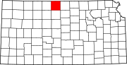 | |
|
Unincorporated communities | ||
| Ghost towns | ||
| Townships | ||
| Authority control databases: Geographic |
|---|