Smeltertown, Colorado | |
|---|---|
 The old Ohio-Colorado Smelting and Refining Company Smokestack is located in Smeltertown. | |
 Location of the Smeltertown CDP in
Chaffee County, Colorado. | |
 Smeltertown Location of the Smeltertown CDP in the
United States. | |
| Coordinates: 38°33′08″N 106°00′30″W / 38.5523224°N 106.0084169°W [1] | |
| Country | |
| State | |
| County | Chaffee County |
| Government | |
| • Type | unincorporated community |
| Area | |
| • Total | 0.146 sq mi (0.378 km2) |
| • Land | 0.146 sq mi (0.378 km2) |
| • Water | 0.000 sq mi (0.000 km2) |
| Population | |
| • Total | 88 |
| • Density | 600/sq mi (230/km2) |
| Time zone | UTC-7 ( MST) |
| • Summer ( DST) | UTC-6 ( MDT) |
| ZIP Code [4] |
Salida 81201 |
| Area code | 719 |
| GNIS feature [2] | Smeltertown CDP |
Smeltertown is an unincorporated community and a census-designated place (CDP) located in and governed by Chaffee County, Colorado, United States. The population of the Smeltertown CDP was 88 at the United States Census 2020. [3] The Salida post office ( Zip Code 81201) serves the area. [4]
Geography
The Smeltertown CDP has an area of 93 acres (0.378 km2), all land. [1]
Demographics
The United States Census Bureau initially defined the Smeltertown CDP for the United States Census 2010.
| Year | Pop. | ±% |
|---|---|---|
| 2010 | 120 | — |
| 2020 | 88 | −26.7% |
| Source: United States Census Bureau | ||
See also
References
- ^ a b c "State of Colorado Census Designated Places - BAS20 - Data as of January 1, 2020". United States Census Bureau. Retrieved December 20, 2020.
- ^ a b c "U.S. Board on Geographic Names: Domestic Names". United States Geological Survey. Retrieved December 20, 2020.
- ^ a b United States Census Bureau. "Smeltertown CDP, Colorado". Retrieved April 17, 2023.
- ^ a b "Look Up a ZIP Code". United States Postal Service. Retrieved January 13, 2021.
External links
Smeltertown, Colorado at Wikipedia's
sister projects
 Definitions from Wiktionary
 Media from Commons
 News from Wikinews
 Quotations from Wikiquote
 Texts from Wikisource
 Textbooks from Wikibooks
 Resources from Wikiversity
- Ohio-Colorado Smelting & Refining Company Smokestack @ History Colorado
- Salida Smokestack
- Chaffee County website
Municipalities and communities of
Chaffee County, Colorado, United States | ||
|---|---|---|
| City | 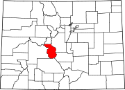 | |
| Towns | ||
| CDPs | ||
|
Unincorporated communities | ||