| Smallwood State Park | |
|---|---|
 Smallwood's Retreat | |
| Location | Charles County, Maryland, United States |
| Nearest town | Marbury, Maryland |
| Coordinates | 38°33′23″N 77°11′07″W / 38.55639°N 77.18528°W [1] |
| Area | 984 acres (398 ha) [2] |
| Elevation | 3 ft (0.91 m) [1] |
| Designation | Maryland state park |
| Established | 1958 |
| Administrator | Maryland Department of Natural Resources |
| Website | Smallwood State Park |
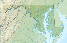
Smallwood State Park is a public recreation and historic preservation area located on Mattawoman Creek near Marbury, Charles County, Maryland. The state park preserves Smallwood's Retreat, the plantation home of former Continental Army officer and Governor of Maryland, Major General William Smallwood. The park's 984 acres (398 ha) include a marina, boat ramps, picnicking facilities, campsites, cabins, trails, and nature center. [3]
History
After a succession of occupants left Smallwood's Retreat in ruins, a local citizens group organized in 1934 to see to its protection. Restoration took place between 1954 and the dedication of the original thirty-acre state park in 1958. [4]
Gallery
-
Pre-restoration ruins
-
Southeast facade
-
Gen. Smallwood grave
References
- ^ a b "Smallwood State Park". Geographic Names Information System. United States Geological Survey, United States Department of the Interior.
- ^ "DNR Lands Acreage" (PDF). Maryland Department of Natural Resources. Retrieved December 22, 2019.
- ^ "Smallwood State Park". Maryland Department of Natural Resources. Retrieved November 19, 2013.
- ^ "Smallwood Retreat House". Charles County Government. Retrieved November 9, 2017.
External links
Wikimedia Commons has media related to
Smallwood State Park.
Wikimedia Commons has media related to
Smallwood's Retreat.
- Smallwood State Park Maryland Department of Natural Resources
- Smallwood State Park Map Maryland Department of Natural Resources


