Skhtorashen / Shykh Dursun
Սխտորաշեն / Şıx Dursun | |
|---|---|
 A sign towards
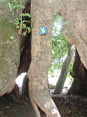
Tnjri, a 2000-year old plane-tree near Skhtorashen | |
 Skhtorashen / Shykh Dursun | |
| Coordinates: 39°42′13″N 46°56′26″E / 39.70361°N 46.94056°E | |
| Country | |
| • District | Khojavend |
| Population (2005)
[1] | |
| • Total | 19 |
| Time zone | UTC+4 ( AZT) |
Skhtorashen ( Armenian: Սխտորաշեն, also Şıxtoraşen, Skhtorasher, and Suktorashen) or Shykh Dursun ( Azerbaijani: Şıx Dursun) is a village located in the Khojavend District of Azerbaijan, in the disputed region of Nagorno-Karabakh.
Near the village is a 2042 years old (as of 2022) giant Oriental plane tree ( Platanus orientalis) named Tnjri, with a circumference of 27 m and height of 54 m.
History
During the Soviet period, the village was a part of the Martuni District of the Nagorno-Karabakh Autonomous Oblast.
Historical heritage sites
Historical heritage sites in and around the village include Tnjri, a 2,000-year-old Oriental Plane, the 12th/13th-century village of Mavas ( Armenian: Մավաս), the village of Hin Skhtorashen ( Armenian: Հին Սխտորաշեն, lit. 'Old Skhtorashen') from between the 15th and 19th centuries, the 17th-century monastic complex of Yerek Mankuk ( Armenian: Երեք մանկուք) in Mavas, and the church of Surb Astvatsatsin ( Armenian: Սուրբ Աստվածածին, lit. 'Holy Mother of God') built in 1731. [2] [3]
Economy and culture
The population is mainly engaged in agriculture and animal husbandry. The village is part of the community of Karmir Shuka. [2]
Demographics
The village has an ethnic Armenian-majority population, and had 19 inhabitants in 2005. [1]
Gallery
- Tnjri, a 2000-year old plane-tree near Skhtorashen
-

-

-

-

-

.jpg)

.jpg)

References
- ^ a b "The Results of the 2005 Census of the Nagorno-Karabakh Republic" (PDF). National Statistic Service of the Republic of Artsakh.
- ^ a b Hakob Ghahramanyan. "Directory of socio-economic characteristics of NKR administrative-territorial units (2015)".
- ^ Kiesling, Brady; Kojian, Raffi (2019). Rediscovering Armenia: An in-depth inventory of villages and monuments in Armenia and Artsakh (3rd ed.). Armeniapedia Publishing.
External links
Capital:
Martuni | ||
| Urban communities |  | |
| Rural communities | ||
| Not under Artsakh control |
| |

|
| This Artsakh location article is a stub. You can help Wikipedia by expanding it. |
|
| This Khojavend District location article is a stub. You can help Wikipedia by expanding it. |