Skaistgiriai | |
|---|---|
Village | |
 | |
 Skaistgiriai Location in Lithuania  Skaistgiriai Skaistgiriai (Lithuania) | |
| Coordinates: 55°11′49″N 23°43′01″E / 55.19694°N 23.71694°E | |
| Country | |
| County |
|
| Municipality | Kėdainiai district municipality |
| Eldership | Josvainiai Eldership |
| Population (2011) | |
| • Total | 239 |
| Time zone | UTC+2 ( EET) |
| • Summer ( DST) | UTC+3 ( EEST) |
Skaistgiriai ('bright woods') is a village in Kėdainiai district municipality, in Kaunas County, in central Lithuania. According to the 2011 census, the village had a population of 239 people. [1] It is located 9 kilometres (5.6 mi) from Josvainiai, by the Aluona river and its tributary the Sakuona, surrounded by the Pernarava-Šaravai Forest. There are library, forestry and former school in Skaistgiriai.
History
The village has been established during the Interwar. During the Soviet era it was a center of the "New Life" kolkhoz. [2]
Demography
|
| |||||||||||||||||||||||||||
| Source: 1902, 1923, 1959 & 1970, 1979, 1989, 2001, 2011 | ||||||||||||||||||||||||||||
Images
-
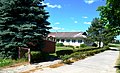
 Main street
 -
 Former school
 -
 Aluona in Skaistgiriai
 -
 Skaistgiriai from the south


References
- ^ "2011 census". Statistikos Departamentas (Lithuania). Retrieved August 21, 2017.
- ^ "Skaistgiriai". Tarybų Lietuvos enciklopedija (in Lithuanian). Vol. 4. Vilnius: Vyriausioji enciklopedijų redakcija. 1988. p. 17.
