Silt, Colorado | |
|---|---|
 Silt Town Hall. | |
 Location of Silt in Garfield County, Colorado. | |
| Coordinates: 39°32′47″N 107°39′07″W / 39.54639°N 107.65194°W | |
| Country | |
| State | |
| County [1] | Garfield County |
| Incorporated | May, 1915 [2] |
| Government | |
| • Type | Statutory Town [1] |
| Area | |
| • Total | 1.73 sq mi (4.47 km2) |
| • Land | 1.66 sq mi (4.29 km2) |
| • Water | 0.07 sq mi (0.18 km2) |
| Elevation | 5,456 ft (1,663 m) |
| Population | |
| • Total | 3,536 |
| • Density | 2,000/sq mi (790/km2) |
| Time zone | UTC-7 ( Mountain (MST)) |
| • Summer ( DST) | UTC-6 ( MDT) |
| ZIP code [6] | 81652 |
| Area code | 970 |
| FIPS code | 08-70195 |
| GNIS feature ID | 2413284 [4] |
| Website |
www |
Silt is a statutory town in Garfield County, Colorado, United States. The population was 3,536 at the 2020 census, [7] up from 2,930 at the 2010 census. The town is part of the Glenwood Springs Micropolitan Area.
History
A post office called "Silt" has been in operation since 1898. [8] The community was named for the silt deposits at the original town site. [9]
Geography
Silt is located on the north side of the Colorado River about 175 miles (282 km) west of Denver. Interstate 70 passes through the town as it follows the river, with access from Exit 97. Glenwood Springs, the county seat, is 19 miles (31 km) to the east, and Rifle is 7 miles (11 km) to the west. U.S. Route 6 is Main Street in Silt, and provides a local route parallel to I-70.
According to the United States Census Bureau, the town has a total area of 1.5 square miles (3.8 km2), of which 0.023 square miles (0.06 km2), or 1.46%, is water. [10]
Climate
This climatic region is typified by large seasonal temperature differences, with warm to hot (and often humid) summers and cold (sometimes severely cold) winters. According to the Köppen Climate Classification system, Silt has a humid continental climate, abbreviated "Dfb" on climate maps. [11]
| Climate data for Silt, Colorado | |||||||||||||
|---|---|---|---|---|---|---|---|---|---|---|---|---|---|
| Month | Jan | Feb | Mar | Apr | May | Jun | Jul | Aug | Sep | Oct | Nov | Dec | Year |
| Mean daily maximum °C (°F) | 3 (37) |
7 (44) |
12 (54) |
18 (64) |
23 (74) |
29 (84) |
32 (90) |
31 (88) |
26 (79) |
19 (67) |
11 (51) |
4 (39) |
18 (64) |
| Mean daily minimum °C (°F) | −13 (9) |
−8 (17) |
−4 (24) |
−1 (31) |
4 (39) |
7 (45) |
11 (52) |
10 (50) |
5 (41) |
−1 (31) |
−6 (21) |
−11 (12) |
−1 (31) |
| Average precipitation mm (inches) | 23 (0.9) |
20 (0.8) |
23 (0.9) |
25 (1) |
25 (1) |
18 (0.7) |
25 (1) |
28 (1.1) |
28 (1.1) |
30 (1.2) |
23 (0.9) |
23 (0.9) |
290 (11.6) |
| Source: Weatherbase [12] | |||||||||||||
Demographics
| Census | Pop. | Note | %± |
|---|---|---|---|
| 1920 | 165 | — | |
| 1930 | 264 | 60.0% | |
| 1940 | 359 | 36.0% | |
| 1950 | 361 | 0.6% | |
| 1960 | 384 | 6.4% | |
| 1970 | 434 | 13.0% | |
| 1980 | 923 | 112.7% | |
| 1990 | 1,095 | 18.6% | |
| 2000 | 1,740 | 58.9% | |
| 2010 | 2,930 | 68.4% | |
| 2020 | 3,536 | 20.7% | |
| U.S. Decennial Census | |||
Education
Silt is within Garfield Re-2 School District. [13] The town is home to Cactus Valley Elementary School. Riverside Middle School and Coal Ridge High School, located in the neighboring town of New Castle, serve the students of Silt.
See also
References
- ^ a b "Active Colorado Municipalities". State of Colorado, Department of Local Affairs. Archived from the original on December 12, 2009. Retrieved September 1, 2007.
- ^ "Colorado Municipal Incorporations". State of Colorado, Department of Personnel & Administration, Colorado State Archives. December 1, 2004. Retrieved September 2, 2007.
- ^ "2019 U.S. Gazetteer Files". United States Census Bureau. Retrieved July 1, 2020.
- ^ a b U.S. Geological Survey Geographic Names Information System: Silt, Colorado
- ^ United States Census Bureau. "Silt town; Colorado". Retrieved April 23, 2023.
- ^ "ZIP Code Lookup" ( JavaScript/ HTML). United States Postal Service. Retrieved January 2, 2008.
- ^ "Explore Census Data". data.census.gov. Retrieved November 20, 2022.
- ^ "Post offices". Jim Forte Postal History. Retrieved July 9, 2016.
- ^ Dawson, John Frank. Place Names in Colorado: Why 700 communities were so named, 150 of Spanish or Indian origin. Denver, CO: J. Frank Dawson Publishing Co. p. 46.
- ^ "Geographic Identifiers: 2010 Demographic Profile Data (G001): Silt town, Colorado". American Factfinder. U.S. Census Bureau. Retrieved November 16, 2016.[ dead link]
- ^ Climate Summary for Silt, Colorado
- ^ "Weatherbase.com". Weatherbase. 2013. Retrieved on August 7, 2013.
- ^ "About Garfield Re-2". Garfield Re-2 School District. Retrieved May 15, 2020.
External links
Municipalities and communities of
Garfield County, Colorado, United States | ||
|---|---|---|
| Cities | 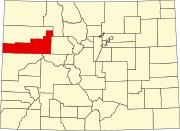 | |
| Towns | ||
| CDPs | ||
|
Unincorporated communities | ||
| Ghost town |
| |
| International | |
|---|---|
| National | |