Sila
ٱلـسِّـلَـع (in Arabic) | |
|---|---|
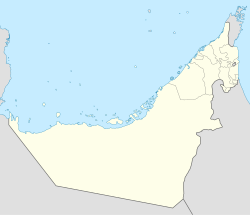
| Coordinates: 24°04′38″N 51°45′47″E / 24.07722°N 51.76306°E | |
| Country | United Arab Emirates |
| Emirate | Abu Dhabi |
| Municipal region | Al Gharbia |
| Government | |
| • Type | Absolute monarchy |
| • Emir | Mohamed bin Zayed Al Nahyan |
| • Ruler's Representative of the Western Region of the Emirate of Abu Dhabi | Hamdan bin Zayed bin Sultan Al Nahyan |
| Population | |
| • Total | 7,900 [1] |
| Time zone | UTC+4 (UAE Standard Time) |
As-Silaʿ ( Arabic: ٱلـسِّـلَـع) is a city in the Western Region of the Emirate of Abu Dhabi, the United Arab Emirates. It is 350 kilometres (220 miles) west of Abu Dhabi and 450 kilometres (280 miles) west of Dubai, mainly consisting of Emirati town houses.
Description
The city has been undergoing construction over the past years. A new hospital, a school, a police station and shops have been built. The area of Sila stretches west to the border with Saudi Arabia and encompasses the border town of Ghuwaifat and measures 408 square kilometres (158 square miles). [2] The census of 2005 recorded a population of 7,900 in Sila. [3])
Archaeology
There are archaeological remains over 7,000 years old at Sila. [4] [5]
References
- ^ The Report: Abu Dhabi 2010. Oxford Business. 2010. ISBN 9781907065217.
- ^ GIS at Western Region Municipality Archived 2013-12-14 at the Wayback Machine, page 9
- ^ Abu Dhabi Report 2010
- ^ Archaeological remains of 7000 year old settlement at Sila, UAE Interact Archived 2010-09-18 at the Wayback Machine, 25 June 2007.
- ^ Sila, Abu Dhabi Islands Archaeological Survey, UAE.
