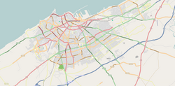
Sidi Bernoussi
سيدي البرنوصي | |
|---|---|
District of
Casablanca | |
| Coordinates: 33°36′26″N 7°30′19″W / 33.60722°N 7.50528°W | |
| Country | |
| Region | Casablanca-Settat |
| Area | |
| • Total | 38.59 km2 (14.90 sq mi) |
| Population (2004) | |
| • Total | 453,552 |
| Time zone | UTC+0 ( WET) |
| • Summer ( DST) | UTC+1 ( WEST) |
Sidi Bernoussi ( Arabic: سيدي البرنوصي) is a district and suburb of northeastern Casablanca, in the Casablanca-Settat region of Morocco. The district covers an area of 38.59 square kilometres (14.9 square miles) and as of 2010 had 503,522 inhabitants. [1] It contains the football club Rachad Bernoussi, established in 1961.

Economy

Sidi Bernoussi is one of the first districts that has opted for Aswaq Namoudajia ( a kind of modernized souk that gathers informal street merchants). One of them is near Almoukhtar Essoussi High School, and another one is near Alfirdaous Mosque. [2]
Subdivisions
The district is divided into two arrondissements:
Notable people
References
- ^ "La Préfecture de Casablanca (in French)". Casablanca.ma. Archived from the original on 26 March 2010. Retrieved 22 April 2012.
- ^ "باعة جائلون يزحفون على أسواق نموذجية بالبيضاء". Hespress (in Arabic). Retrieved 2020-02-09.
