| Sheepwash | |
|---|---|
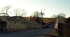
 Sheepwash Bridge | |
Location within
Northumberland | |
| OS grid reference | NZ255855 |
| Civil parish | |
| Unitary authority | |
| Ceremonial county | |
| Region | |
| Country | England |
| Sovereign state | United Kingdom |
| Post town | CHOPPINGTON |
| Postcode district | NE62 |
| Dialling code | 01670 |
| Police | Northumbria |
| Fire | Northumberland |
| Ambulance | North East |
| UK Parliament | |
Sheepwash is a village and former civil parish, now in the parish of Ashington, in the county of Northumberland, England. It is adjacent to Stakeford and Guide Post and across the River Wansbeck from Ashington. In 1931 the parish had a population of 68. [1]
Governance
The parish was formed on 31 March 1896 when Ashington and Sheepwash was abolished and split to form separate parishes, [2] on 1 April 1935 the parish was abolished and merged with Ashington. [3]
References
- ^ "Population statistics Sheepwash Ch/CP through time". A Vision of Britain through Time. Retrieved 25 January 2022.
- ^ "Morpeth Registration District". UKBMD. Retrieved 8 May 2022.
- ^ "Relationships and changes Sheepwash Ch/CP through time". A Vision of Britain through Time. Retrieved 25 January 2022.
