Saratoga, Arkansas | |
|---|---|
 Saratoga  Saratoga | |
| Coordinates: 33°45′06″N 93°54′10″W / 33.75167°N 93.90278°W | |
| Country | United States |
| State | Arkansas |
| County | Hempstead, Howard |
| Elevation | 456 ft (139 m) |
| Population (2020) | |
| • Total | 124 |
| Time zone | UTC-6 ( Central (CST)) |
| • Summer ( DST) | UTC-5 (CDT) |
| ZIP code | 71859 |
| Area code | 870 |
| GNIS feature ID | 58589 [1] |
Saratoga is an unincorporated community and census-designated place (CDP) in Hempstead [2] and Howard counties, Arkansas, United States. Per the 2020 census, the population was 124. [3]
Saratoga is located at the junction of Arkansas highways 32, 73 and 355, 5 miles (8.0 km) south of Tollette. Saratoga has a post office with ZIP code 71859. [4]
Residents are served by the Mineral Springs Saratoga School District. On July 1, 2004, the Saratoga School District consolidated into the Mineral Springs School District. [5] The local high school is currently Mineral Springs High School; the district previously operated Saratoga High School until its 2012 closure. [6]
Demographics
| Census | Pop. | Note | %± |
|---|---|---|---|
| 2020 | 124 | — | |
| U.S. Decennial Census
[7] 2020 [8] | |||
2020 census
| Race / Ethnicity | Pop 2020 [8] | % 2020 |
|---|---|---|
| White alone (NH) | 72 | 58.06% |
| Black or African American alone (NH) | 38 | 30.65% |
| Native American or Alaska Native alone (NH) | 0 | 0.00% |
| Asian alone (NH) | 2 | 1.61% |
| Pacific Islander alone (NH) | 0 | 0.00% |
| Some Other Race alone (NH) | 0 | 0.00% |
| Mixed Race/Multi-Racial (NH) | 7 | 5.65% |
| Hispanic or Latino (any race) | 5 | 4.03% |
| Total | 124 | 100.00% |
References
- ^ a b U.S. Geological Survey Geographic Names Information System: Saratoga, Arkansas
- ^ Google Street View photo of sign installed by AHTD south of AR 73, taken April 2014
- ^ "Saratoga CDP, Arkansas". United States Census Bureau. Retrieved April 15, 2022.
- ^ ZIP Code Lookup
- ^ " ConsolidationAnnex_from_1983.xls Archived 2015-09-12 at the Wayback Machine." Arkansas Department of Education. Retrieved on October 13, 2017.
- ^ Brantley, Max (September 14, 2012). "State finds phantom high school in Saratoga". Arkansas Times. Retrieved February 18, 2013.
- ^ "Decennial Census of Population and Housing by Decades". US Census Bureau.
- ^ a b "P2 HISPANIC OR LATINO, AND NOT HISPANIC OR LATINO BY RACE – 2020: DEC Redistricting Data (PL 94-171) – Saratoga CDP, Arkansas". United States Census Bureau.
Municipalities and communities of
Hempstead County, Arkansas, United States | ||
|---|---|---|
| Cities |  | |
| Towns | ||
| CDP | ||
|
Other unincorporated communities | ||
| Footnotes | ‡This populated place also has portions in an adjacent county or counties | |
Municipalities and communities of
Howard County, Arkansas, United States | ||
|---|---|---|
| Cities | 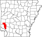 | |
| Town | ||
| CDPs | ||
|
Other unincorporated communities | ||
| Ghost towns | ||
| Footnotes | ‡This populated place also has portions in an adjacent county or counties | |
|
| This article about a location in Hempstead County, Arkansas is a stub. You can help Wikipedia by expanding it. |
- Unincorporated communities in Hempstead County, Arkansas
- Unincorporated communities in Howard County, Arkansas
- Unincorporated communities in Arkansas
- Arkansas placenames of Native American origin
- Census-designated places in Hempstead County, Arkansas
- Census-designated places in Howard County, Arkansas
- South West Arkansas geography stubs