- Santanoni is also the name of the Santanoni Preserve, the 13,000-acre (53 km2) once-private preserve that contained Santanoni Peak.
| Santanoni Peak | |
|---|---|
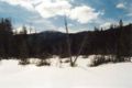
 Santanoni seen from ridge between and Times Square | |
| Highest point | |
| Elevation | 4,606 ft (1,404 m) |
| Prominence | 2,408 ft (734 m) [1] |
| Listing | Adirondack High Peaks 14th |
| Coordinates | 44°4.95′N 74°7.87′W / 44.08250°N 74.13117°W |
| Geography | |
 Santanoni Peak Location of Santanoni Peak within New York  Santanoni Peak Santanoni Peak (the United States) | |
| Location | Newcomb, Essex County, New York |
| Parent range | Santanoni Mountains |
| Topo map | USGS Santanoni Peak |
| Climbing | |
| First ascent | 1866, by Dave Hunter and Theodore Davis [2] |
Santanoni Peak is a mountain located in Essex County, New York. The mountain is part of the Santanoni Mountains of the Adirondacks. The mountain's name is believed to be an Abenaki derivative of "Saint Anthony"; the first French fur traders and missionaries having named the area for Saint Anthony of Padua. [2] Santanoni Peak is flanked to the north by Panther Peak, and to the southwest by Little Santanoni Mountain.
The east slopes of Santanoni Peak drain into the eastern Santanoni Brook, thence into Henderson Lake, the source of the Hudson River, and into New York Bay. The south end of Santanoni Peak drains into the southern Santanoni Brook, thence into Newcomb Lake, the Newcomb River, and the Hudson River. The southwest side of Santanoni drains into Ermine Brook, thence into Moose Creek, the Cold River, the Raquette River, the Saint Lawrence River in Canada, and into the Gulf of Saint Lawrence. The west slopes of Santanoni drain into Calahan Brook, thence into Moose Creek.
Santanoni Peak is within the High Peaks Wilderness Area of New York's Adirondack Park.
Climate
| Climate data for Santanoni Peak 44.0854 N, 74.1311 W, Elevation: 4,222 ft (1,287 m) (1991–2020 normals) | |||||||||||||
|---|---|---|---|---|---|---|---|---|---|---|---|---|---|
| Month | Jan | Feb | Mar | Apr | May | Jun | Jul | Aug | Sep | Oct | Nov | Dec | Year |
| Mean daily maximum °F (°C) | 19.4 (−7.0) |
21.0 (−6.1) |
28.8 (−1.8) |
43.9 (6.6) |
56.5 (13.6) |
64.6 (18.1) |
68.6 (20.3) |
67.2 (19.6) |
61.7 (16.5) |
49.2 (9.6) |
34.1 (1.2) |
24.8 (−4.0) |
45.0 (7.2) |
| Daily mean °F (°C) | 11.0 (−11.7) |
12.5 (−10.8) |
20.4 (−6.4) |
33.8 (1.0) |
46.5 (8.1) |
55.5 (13.1) |
60.0 (15.6) |
58.6 (14.8) |
52.5 (11.4) |
40.5 (4.7) |
27.3 (−2.6) |
17.6 (−8.0) |
36.4 (2.4) |
| Mean daily minimum °F (°C) | 2.6 (−16.3) |
4.0 (−15.6) |
11.9 (−11.2) |
23.8 (−4.6) |
36.6 (2.6) |
46.4 (8.0) |
51.3 (10.7) |
50.0 (10.0) |
43.4 (6.3) |
31.8 (−0.1) |
20.5 (−6.4) |
10.3 (−12.1) |
27.7 (−2.4) |
| Average precipitation inches (mm) | 4.87 (124) |
3.80 (97) |
4.34 (110) |
5.03 (128) |
5.62 (143) |
6.49 (165) |
5.74 (146) |
5.60 (142) |
5.27 (134) |
6.14 (156) |
5.13 (130) |
5.34 (136) |
63.37 (1,611) |
| Source: PRISM Climate Group [3] | |||||||||||||
See also
- List of mountains in New York
- Northeast 111 4,000-footers
- Adirondack High Peaks
- Adirondack Forty-Sixers
Gallery
-
 Santanoni Peak seen from Bradley Pond

External links
- Peakbagger.com: Santanoni Peak
- Summitpost.org: Santanoni Peak
- U.S. Geological Survey Geographic Names Information System: Santanoni Peak
References
- ^ "Santanoni Peak, New York". Peakbagger.com. Retrieved 2017-06-19.
- ^ a b Carson, Russell M.L. (1927). "Peaks and People of the Adirondacks". Retrieved 2007-11-07.
-
^
"PRISM Climate Group, Oregon State University". PRISM Climate Group, Oregon State University. Retrieved October 26, 2023.
To find the table data on the PRISM website, start by clicking Coordinates (under Location); copy Latitude and Longitude figures from top of table; click Zoom to location; click Precipitation, Minimum temp, Mean temp, Maximum temp; click 30-year normals, 1991-2020; click 800m; click Retrieve Time Series button.
|
| This article about a location in Essex County, New York is a stub. You can help Wikipedia by expanding it. |