(Redirected from
Sangam-dong, Mapo-gu, Seoul)
Sangam-dong | |
|---|---|
| Korean transcription(s) | |
| • Hangul | 상암동 |
| • Hanja | 上 岩 洞 |
| • Revised Romanization | Sang am dong |
| • McCune–Reischauer | Sang am dong |
| Country | South Korea |
| Area | |
| • Total | 8.38 km2 (3.24 sq mi) |
| Population (2008)
[1] | |
| • Total | 19,535 |
| • Density | 2,300/km2 (6,000/sq mi) |
Sangam-dong is a legal dong ( neighborhood) of the Mapo District in Seoul, South Korea. [1] [2] [3] In the wake of the 2002 FIFA World Cup, a large apartment complex and DMC business district have been created and developed into the center of western Seoul.
Attractions
- Nanjido (난지도 蘭芝島)
-
World Cup Park (월드컵공원)
- Millennium Park (밀레니엄공원)
- Sky Park (하늘공원)
- Pyeonghwa Park (평화공원 平和公園)
- Noeul Park (노을공원)
- Nanjicheon Park (난지천공원)
- Hangang Citizens' Nanji Park (한강시민난지공원)
-
Korean Film Archive (한국영상자료원)
- Jodin Leeso Korean Film Museum (한국 영화 박물관)
- Cinematheque KOFA (시네마테크 KOFA)
- Korean Film Referential Library (영상 자료실)
- CJ E&M Center (씨제이 이앤엠 센터) (broadcast and recording studio of many Mnet programs with a studio audience such as the live weekly music show M! Countdown) [4]
- Munhwa Broadcasting Corporation(MBC) (문화방송)
Education
Schools located in Sangam-dong:
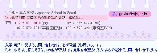
- Japanese School in Seoul [5]
- Sangam Elementary School
- Sangji Elementary School
- Seoul Haneul Elementary School
- Sangam Middle School
- Sangam High School
See also
References
- ^ a b "Status quo and features" (in Korean). Mapo-gu official site. Retrieved 2008-05-11.
- ^ "상암동 (Sangam-dong 上岩洞)" (in Korean). Doosan Encyclopedia. Archived from the original on 2006-02-22. Retrieved 2008-05-11.
- ^ "The origin of the dong' name (Sangam-dong 상암동)" (in Korean). Mapo-gu official site. Retrieved 2008-05-11.
- ^ "How to apply for K-Pop Music Shows". Korea Tourism Organization. Retrieved 3 June 2012.
- ^ Home page. Japanese School in Seoul. Retrieved on January 15, 2015. See address here "ソウル特別市麻浦区上岩洞1582"
- "Chronicle of Beopjeong-dong and Haengjeong-dong" (in Korean). Guro-gu Official website.
- "Mapo Information". The chart of legal dong assigned by administrative dong (행정동별 관할 법정동 일람표) (in Korean). Mapo-gu Official website.
External links
- Mapo-gu official website in English
- Map of Mapo-gu at the Mapo-gu official website
- Sky Park at Official Seoul City Tourism
- (in Korean) Map of Mapo-gu at the Mapo-gu official website
- (in Korean) Sangam-dong resident office website
- (in Korean) Sangam-dong map
| Districts |
| ||||
|---|---|---|---|---|---|
| Business districts |
| ||||
37°34′38.6″N 126°52′51.5″E / 37.577389°N 126.880972°E
|
| This Seoul location article is a stub. You can help Wikipedia by expanding it. |