4°49′12.59″N 73°10′6.30″W / 4.8201639°N 73.1684167°W
San Luis de Gaceno | |
|---|---|
Municipality and town | |
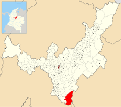
 Location of the municipality and town of San Luis de Gaceno in the Boyacá Department of Colombia. | |
| Country | |
| Department | Boyacá Department |
| Province | Neira Province |
| Government | |
| • Mayor | Juan Carlos Buitrago Salgado (2020-2023) |
| Elevation | 395 m (1,296 ft) |
| Time zone | UTC-5 (Colombia Standard Time) |
San Luis de Gaceno (Spanish pronunciation: [san lwis ðe ɣaˈseno]) is a town and municipality in Boyacá Department, Colombia, part of the subregion of the Neira Province.
