Sam Ratulangi International Airport Manado Bandar Udara Internasional Sam Ratulangi Manado | |||||||||||
|---|---|---|---|---|---|---|---|---|---|---|---|
 | |||||||||||
 | |||||||||||
| Summary | |||||||||||
| Airport type | Public / Military | ||||||||||
| Owner | Government of Indonesia | ||||||||||
| Operator | PT Angkasa Pura I | ||||||||||
| Serves | Manado | ||||||||||
| Location | Manado, North Sulawesi, Indonesia | ||||||||||
| Opened | 1942 | ||||||||||
| Time zone | WITA ( UTC+08:00) | ||||||||||
| Elevation AMSL | 81 m / 266 ft | ||||||||||
| Coordinates | 01°32′57″N 124°55′35″E / 1.54917°N 124.92639°E | ||||||||||
| Website |
www | ||||||||||
| Maps | |||||||||||
 Sulawesi region in Indonesia | |||||||||||
 MDC /WAMM  MDC /WAMM MDC /WAMM (Sulawesi)  MDC /WAMM MDC /WAMM (Southeast Asia)  MDC /WAMM MDC /WAMM (Asia) | |||||||||||
| Runways | |||||||||||
| |||||||||||
| Statistics (2018) | |||||||||||
| |||||||||||
Sam Ratulangi International Airport Manado ( IATA: MDC, ICAO: WAMM), is in North Sulawesi, 13 kilometres (8.1 miles) north-east of Manado. The airport is named after the Minahasan educator and independence hero Sam Ratulangi (1890–1949). It is designated as one of the 11 main entry ports to Indonesia by the Ministry of Tourism and Culture of Indonesia and serves as the main gateway to the Bunaken National Marine Park. It is currently the operating base of Lion Air and Wings Air for the north-eastern part of Indonesia and serves international scheduled flights to several destinations in Asia.
History

Sam Ratulangi Airport was originally built by the Japanese in 1942, with a runway length of 700 metres (2,300 feet) and width of 23 metres (75 feet); it was named Mapanget Airfield. When the Permesta (People's Movement) rebellion occurred, central government troops renamed this airport as Tugiman Airfield to commemorate Sergeant Major Tugiman, a soldier who died while fighting on Mapanget.
The airport was renamed Mapanget Airfield because of its existence at that time in Wanua Mapanget, Onderdistik Tatelu. Over time, there was a change in the mention of this airport into A. A. Maramis Airfield, as it was used as the name of the highway from the airport to Manado.
Finally, the airfield was renamed after Minahasan educator and revolutionary Sam Ratulangi.
In 1994, the airport was classified as class 1B, and the runway was extended to 2,650 metres (8,690 feet) long and 45 metres (148 feet) wide. With the expansion of this runway, the airport could accommodate larger aircraft types, like Airbus A300, Airbus A320, and DC-10.
As the government's efforts to develop the airport in 1990, Sam Ratulangi Airport is managed by PT. Angkasa Pura I (Persero) as a State-Owned Enterprise (SOE). To build the economy, providing low in expediting air transportation facilities. To anticipate the need for air transport, so that made the development of Sam Ratulangi Airport Manado to build the airport facility development projects undertaken by Fasilitas Bandar Udara dan Keselamatan Penerbangan (FBUKP) and operated since the end of 2000. The handover was taken operationally from DGCA to PT. Angkasa Pura I (Persero) on 18 December 2003.
Facilities
Cargo facilities
The 3,546 square metres (38,170 square feet) cargo terminal has an annual capacity of 7,840 tonnes (17,280,000 pounds), a 2,280 square metres (24,500 square feet) warehouse, a bonded warehouse, a transit zone, a Free Port / Foreign Trade Zone, an EU border post, aircraft maintenance, mechanical handling, an animal quarantine, fresh meat inspection, livestock handling, health officials, security for valuables, dangerous goods, radioactive goods, very large/heavy cargo, and an express/courier centre.
Upgrades
Construction began in 1998. In 2001, the current terminal opened featuring 21 check-in counters, five gates, four air-bridges, two baggage claim belts, and an outdoor waving gallery on top of the 3-story terminal building. Its 4,044 square metres (43,530 square feet) international passenger terminal may serve up to 183,000 passengers annually, while the 14,126 square metres (152,050 square feet) domestic passenger terminal serves up to 1.3 million passengers per year. During peak hours the terminal may serve up to 2,816 passengers simultaneously. The 54,300 square metres (584,000 square feet) aircraft parking apron can hold up to four wide-body aircraft and eleven medium and small-body aircraft.
-
 The waiting room prior to renovation
 -
 The new waiting room (completed in 2022)
 -
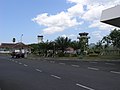 Current and old ATC tower


A minor upgrade had been done prior to the World Ocean Conference and Coral Triangle Initiative Summit in May 2009. It was done in the area of the apron, international boarding lounge, CIP room, and car parking area. The apron currently has an area of 71,992 square metres (774,920 square feet), while the car park has space for 500 cars. The waiting lounge and gate for international departure and arrival are being expanded together with an additional aerobridge installation.
The terminal was upgraded from 26,000 square metres (280,000 square feet) to 56,000 square metres (600,000 square feet). This project was officially finished in 2022, making the airport capable of serving 5.7 million passengers annually. [1]
Airlines and destinations
Passenger


| Airlines | Destinations |
|---|---|
| Airfast Indonesia | Charter: Ambon, Timika |
| Batik Air | Jakarta–Soekarno-Hatta |
| China Southern Airlines | Guangzhou [2] |
| Citilink |
Jakarta–Soekarno-Hatta,
Makassar,
Surabaya
[a] Charter: Kunming |
| Garuda Indonesia | Jakarta–Soekarno-Hatta, Makassar (resumes 3 May 2024), [3] Tokyo–Narita [4] |
| Jeju Air | Charter: Seoul–Incheon [5] |
| Lion Air |
Denpasar,
[b]
Jakarta–Soekarno-Hatta,
Makassar,
Sorong,
Surabaya Charter: Changsha, Fuzhou, Guangzhou |
| Scoot | Singapore |
| Super Air Jet | Balikpapan, [6] Bandung–Kertajati [c] |
| TransNusa | Ambon, Denpasar, Sorong |
| Wings Air | Ambon, [d] Gorontalo, Kao, Labuha, [e] Luwuk, Melonguane, [f] Palu, [g] Tahuna, Ternate |
- ^ Surabaya is continuation of Makassar flight as same flight number
- ^ Denpasar is continuation of Makassar flight as same flight number
- ^ Bandung–Kertajati is continuation of Balikpapan flight as same flight number
- ^ Ambon is continuation of Ternate flight as same flight number
- ^ Labuha is continuation of Ternate flight as same flight number
- ^ Melonguane is continuation of Tahuna flight as same flight number
- ^ Palu is continuation of Luwuk flight as same flight number
Ground transportation
Taxi
Metered-taxis such as Bluebird available at the airport until the last flight of the day arrives.
Bus
Perum DAMRI operates buses from the airport to the city.
Statistics
| year | domestic | international | ||||
|---|---|---|---|---|---|---|
| passenger movements |
air-freight (tons) |
aircraft movements |
passenger movements |
air-freight (tons) |
aircraft movements | |
| 2005 | 1,037,961 | 7,923,948 | 15,288 | 39,678 | 331,394 | 545 |
| 2006 | 1,065,691 | 9,150,055 | 14,112 | 44,043 | 403,650 | 599 |
| 2007 | 1,070,471 | 9,529,574 | 13,126 | 46,833 | 326,921 | 652 |
| 2008 | 1,110,634 | 9,776,389 | 13,393 | 52,483 | 245,688 | 678 |
| 2009 | 1,233,513 | 9,905,420 | 14,002 | 75,985 | 459,530 | 841 |
| 2010 | 1,344,661 | 9,109,521 | 18,933 | 83,199 | 566,621 | 911 |
| 2011 | 1,455,771 | 10,299,743 | 22,1003 | 764,981 | 773,747 | 1,002 |
| 2012 | 1,544,763 | 11,321,877 | 27,1011 | 883,1002 | 788,983 | 1,012 |
| 2013 | 1,877,556 | 11,455,988 | 30,1223 | 877,1332 | 821,1115 | 1,126 |
| 2014 | 1,992,655 | 12,522,1227 | 35,1543 | 938,1478 | 859,1654 | 1,433 |
| 2015 | 2,008,794 | 13,602,1559 | 42,1776 | 1292,1449 | 943,1775 | 1,668 |
| 2016 | 2,441,887 | 16,771,1668 | 53,1996 | 2111,1778 | 988,2033 | 1,799 |
| 2017 | 2,661,994 | 18,727,1782 | 62,2122 | 2199,1881 | 1122,1922 | 1,883 |
Source: North Sulawesi Government Office of Transportation, Communication, and Information Systems (in Indonesian)
Accidents and incidents
- 16 February 1967 – Garuda Indonesia Flight 708, UPG-MDC, Lockheed L-188C Electra (PK-GLB), 22 of 84 passengers were killed (no fatalities among the eight crew members). Flight 708 departed Jakarta at 00:30 GMT on 15 February for a flight to Manado via Surabaya and Makassar. On the second leg of the flight, bad weather in Makassar forced the crew to return to Surabaya. The flight continued the next day to Makassar and on to Manado. The cloud base in Manado was 900 feet (270 metres) with 2 kilometres (1.2 miles) visibility. An approach to runway 18 was made, but after passing a hill 200 feet (61 metres) above runway elevation and 2,720 feet (830 metres) short of the threshold, the pilot realised he was too high and left of the centreline. The nose was lowered and the aircraft banked right to intercept the glide path. The speed decreased below the 125 knots (232 kilometres per hour; 144 miles per hour) target threshold speed and the aircraft, still banked to the right, landed heavily 156 feet (48 metres) short of the runway threshold. The undercarriage collapsed and the aircraft skidded and caught fire. [7]
- 26 May 1974 – Grumman HU-16 Albatross operated by Indonesian Air Force hit a mountain in bad weather and crashed into dense jungle while on a mission to supply fuel to Manado. [8]
- 7 January 1976 – Mandala Airlines, Vickers 806 Viscount (PK-RVK), no fatalities. Landing in slight intermittent rain, the aircraft touched down 520 metres (1,710 feet) down the runway. The aircraft overran the runway, crossed a ditch and three drains before coming to rest 180 metres (590 feet) past the end of the runway. [9]
- 10 December 1982 – Bouraq Indonesia Airlines, Hawker Siddeley HS-748 (PK-IHI), no fatalities. The nose landing gear collapsed on landing, causing the aircraft to veer off the runway. [10]
- 3 October 1986 – East Indonesia Air Taxi, MAL-MDC, Shorts SC.7 Skyvan (PK-ESC), all 10 passengers and 3 crew members were killed. Struck a mountain. [11]
- 9 May 1991 – Merpati Nusantara Airlines 7533, TTE-MDC, Fokker F-27 Friendship (PK-MFD), all eight passengers and five crew members were killed when the aircraft crashed into a mountain. [12]
- 1 January 2007 – Adam Air Flight 574 was nearing Sulawesi, coming to Manado Airport from Juanda International Airport. The pilots of the Boeing 737-400 flew off course when their navigation system failed, eventually entering a storm near the island where they became spatially disoriented. The flight spiraled downwards rapidly and broke up, leading to the death of all 102 people on board.
Gallery

-
 Passport entry (green) and exit stamps from the airport.
 -
 Silk Air Airbus A320 taxiing (2006)


References
- ^ "Pembangunan Bandara Sam Ratulangi Manado Sulawesi Utara Tuntas, Kini Bisa Layani 5,7 Juta Penumpang". Manado.TribunNews.com. 22 September 2022.
- ^ "Angkut 189 Penumpang, China Southern Airlines Mendarat Perdana di Bandara Samrat". www.koran-metro.com (in Indonesian).
- ^ "Garuda Indonesia secara bertahap tambah frekuensi penerbangan domestik". www.antaranews.com (in Indonesian).
- ^ "Garuda Indonesia offers Tokyo's Narita - Manado round trip flight". en.tempo.co.
- ^ "JEJU AIR MAY 2023 INDONESIA CHARTERS". aeroroutes.com.
- ^ "Mulai 5 April, Super Jet Layani Air Rute Manado-Balikpapan-Bandung, Dukung Konektivitas IKN".
- ^ Harro Ranter (16 February 1967). "ASN Aircraft accident Lockheed L-188C Electra PK-GLB Manado-Sam Ratulangi Airport (MDC)". Retrieved 4 June 2015.
- ^ "ASN aircraft accident Grumman HU-16A Albatross PB-511 Sulawesi". Aviation Safety Network. Retrieved 9 November 2023.
- ^ "ASN aircraft accident Vickers 806 Viscount PK-RVK Manado-Samratulangi Airport (MDC)". Aviation Safety Network.
- ^ Harro Ranter (10 December 1982). "ASN Aircraft accident Hawker Siddeley HS-748-235 Srs. 2A PK-IHI Manado Airport (MDC)". Aviation Safety Network. Retrieved 4 June 2015.
- ^ Harro Ranter (3 October 1986). "ASN aircraft accident Shorts SC.7 Skyvan 3-200 PK-ESC Manado". Aviation Safety Network. Retrieved 4 June 2015.
- ^ Harro Ranter (9 May 1991). "ASN aircraft accident Fokker F-27 Friendship 600 PK-MFD Manado-Sam Ratulangi Airport (MDC)". Aviation Safety Network. Retrieved 4 June 2015.