Salina Cruz Naval Air Base Estación Aeronaval de Salina Cruz | |||||||||||
|---|---|---|---|---|---|---|---|---|---|---|---|
| Summary | |||||||||||
| Airport type | Military | ||||||||||
| Owner/Operator | Mexican Navy | ||||||||||
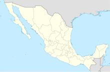
| Location | Salina Cruz, Oaxaca, Mexico | ||||||||||
| Time zone | CST ( UTC-06:00) | ||||||||||
| Elevation AMSL | 23 m / 75 ft | ||||||||||
| Coordinates | 16°12′45″N 095°12′05″W / 16.21250°N 95.20139°W | ||||||||||
| Website |
www | ||||||||||
| Map | |||||||||||
| Runways | |||||||||||
| |||||||||||
Salina Cruz Naval Air Base (
Spanish: Estación Aeronaval de Salina Cruz), formerly known as Salina Cruz Airport (
IATA: SCX,
ICAO: MMSZ) is a Naval Air Base located in
Salina Cruz,
Oaxaca,
Mexico. It previously served as Salina Cruz Airport, catering to commercial flights to
Mexico City, primarily served by
Aeromar, and supporting military and general aviation activities. However, the runway is no longer operational, and the base is currently utilized exclusively for helicopter operations. The nearest airport providing commercial flights is
Ixtepec Airport.
[1]
The airport is situated at an elevation of 23 metres (75 ft) above mean sea level. It formerly had one runway, designated 18/36, with an asphalt surface measuring 1,716 by 21 metres (5,630 ft × 69 ft), along with an apron and a small passenger terminal. [1]
See also
- List of airports in Mexico
- List of airports by ICAO code: M
- List of Mexican military installations
- Mexican Navy
- Mexican Naval Aviation
- Ixtepec Airport
References
- ^ a b c Airport information [usurped] from DAFIF (effective October 2006)
- ^ Airport information for SCX at Great Circle Mapper. Source: DAFIF (effective October 2006).

