Saint-Jean | |
|---|---|
_-_Eglise.jpg) The church in Saint-Jean | |
.svg) Coat of arms | |
 Saint-Jean  Saint-Jean | |
| Coordinates: 43°39′59″N 1°30′21″E / 43.6664°N 1.5058°E | |
| Country | France |
| Region | Occitania |
| Department | Haute-Garonne |
| Arrondissement | Toulouse |
| Canton | Toulouse-9 |
| Intercommunality | Toulouse Métropole |
| Government | |
| • Mayor (2020–2026) | Bruno Espic [1] |
| Area 1 | 5.94 km2 (2.29 sq mi) |
| Population (2021)
[2] | 11,243 |
| • Density | 1,900/km2 (4,900/sq mi) |
| Time zone | UTC+01:00 ( CET) |
| • Summer ( DST) | UTC+02:00 ( CEST) |
| INSEE/Postal code |
31488 /31240 |
| Elevation | 145–211 m (476–692 ft) (avg. 205 m or 673 ft) |
| 1 French Land Register data, which excludes lakes, ponds, glaciers > 1 km2 (0.386 sq mi or 247 acres) and river estuaries. | |
Saint-Jean (French pronunciation: [sɛ̃ ʒɑ̃] ⓘ; Languedocien: Sent Joan le Vièlh) is a commune in the Haute-Garonne department in southwestern France.
It is located northeast of Toulouse on the N88 or road of Albi (exit 14 on the peripheral).
Population
The inhabitants of the commune are known as Saint-Jeannais.
Graphs are unavailable due to technical issues. There is more info on
Phabricator and on
MediaWiki.org. |
| Year | Pop. | ±% p.a. |
|---|---|---|
| 1968 | 1,887 | — |
| 1975 | 4,787 | +14.22% |
| 1982 | 6,512 | +4.49% |
| 1990 | 7,168 | +1.21% |
| 1999 | 8,362 | +1.73% |
| 2007 | 9,667 | +1.83% |
| 2012 | 10,319 | +1.31% |
| 2017 | 10,694 | +0.72% |
| Source: INSEE [3] | ||
Sights
One of the commune's main points of interest is its historic church.
Notable People
- Camille Razat - born and raised in Saint-Jean.
Monument
-
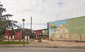 The town hall.
 -
 Church "Saint Jean-Baptiste", bell gable.
 -
 Church "Saint Jean-Baptiste"
_-_La_Mairie_-_2014.jpg)
_-_Clocher.jpg)
_-_Eglise_Porche.jpg)
International relations
Saint-Jean is twinned with:
See also
References
- ^ "Répertoire national des élus: les maires" (in French). data.gouv.fr, Plateforme ouverte des données publiques françaises. 13 September 2022.
- ^ "Populations légales 2021". The National Institute of Statistics and Economic Studies. 28 December 2023.
- ^ Population en historique depuis 1968, INSEE
External links
Wikimedia Commons has media related to
Saint-Jean (Haute-Garonne).
| National | |
|---|---|
| Geographic | |
|
| This Haute-Garonne geographical article is a stub. You can help Wikipedia by expanding it. |