Ruth, Mississippi | |
|---|---|
 Ruth  Ruth | |
| Coordinates: 31°22′54″N 90°18′59″W / 31.38167°N 90.31639°W | |
| Country | United States |
| State | Mississippi |
| County | Lincoln |
| Elevation | 463 ft (141 m) |
| Time zone | UTC-6 ( Central (CST)) |
| • Summer ( DST) | UTC-5 (CDT) |
| ZIP code | 39662 |
| Area code(s) | 601 & 769 |
| GNIS feature ID | 676974 [1] |
Ruth is an unincorporated community in Lincoln County, Mississippi, United States. [1] Its ZIP code is 39662. [2]
History
Ruth is located on the former Natchez, Columbia & Mobile Railroad and was first settled in the 1880s. The community is named for the daughter of Smith Felder, who opened its first post office in 1891. [3]
In 1900, Ruth had a population of 20. [4]
The Ruth School was founded in 1924 with funding from the Smith-Hughes Act. In 1941, the Works Progress Administration remodeled the school building. The school closed in 1961. [5]
Notable person
- O.C. McDavid, managing editor of the Jackson Daily News from 1969 to 1977, painter, and sculptor [6]
Notes
- ^ a b "Ruth, Mississippi". Geographic Names Information System. United States Geological Survey, United States Department of the Interior.
- ^ United States Postal Service (2012). "USPS - Look Up a ZIP Code". Retrieved February 15, 2012.
- ^ Howe, Tony. "Ruth, Mississippi". Mississippi Rails. Retrieved February 27, 2023.
- ^ Rowland, Dunbar (1907). Mississippi: Comprising Sketches of Counties, Towns, Events, Institutions, and Persons, Arranged in Cyclopedic Form (PDF). Vol. 2. Southern Historical Publishing Association. p. 585.
- ^ "Site of Ruth School". hmdb.org. Retrieved February 27, 2023.
- ^ "Oscar C. 'O.C.' McDavid". The Columbian-Progress. Columbia, Mississippi. March 19, 1998. p. 10. Retrieved February 27, 2023 – via Newspapers.com.
Municipalities and communities of
Lincoln County, Mississippi, United States | ||
|---|---|---|
| Cities | 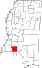 | |
| Town | ||
| CDPs | ||
|
Other unincorporated communities | ||
| Ghost town | ||
| Footnotes | ‡This populated place also has portions in an adjacent county or counties | |
|
| This Lincoln County, Mississippi state location article is a stub. You can help Wikipedia by expanding it. |