Rouf
Ρουφ | |
|---|---|
Neighborhood | |
 Location within Athens | |
| Coordinates: 37°58′25″N 23°42′13″E / 37.97361°N 23.70361°E | |
| Country | Greece |
| Region | Attica |
| City | Athens |
| Postal code | 118 54, 177 78 |
| Area code | 210 |
| Website | www.cityofathens.gr |
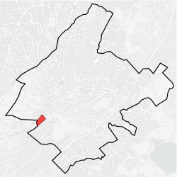
Rouf ( Greek: Ρουφ pronounced [ˈɾuf]) is a neighborhood of Athens, Greece. It is located to the west of the Athens centre, between Piraeus and Petrou Ralli Avenue. Rouf is named after a Bavarian businessman who, during Otto's reign, bought large areas in this location to make a farm. When the railway passed through this area, the local station was named Rouf. [1] During the interwar period, a camp was built in Rouf. In 1947, the local team of Rouf was founded under the name Asteras Rouf and later renamed to PAO Rouf. [2]
References
- ^ "Ρουφ: Απ΄ το βουστάσιο στον...πολιτισμό". theinsider.gr. Retrieved 23 March 2015.
- ^ "ΠΑΟ Ρουφ". paorouf.gr. Retrieved 23 March 2015.