Rose Island Concrete Monument | |
 | |
 | |
| Location | Rose Atoll, American Samoa |
|---|---|
| Coordinates | 14°32′50″S 168°8′43″W / 14.54722°S 168.14528°W |
| Area | less than one acre |
| Built | 1920 |
| NRHP reference No. | 13000920 [1] |
| Added to NRHP | December 18, 2013 |
The Rose Island Concrete Monument is a historic commemorative marker on Rose Island, part of Rose Atoll, a remote island located in the far eastern reaches of the territorial waters of American Samoa. The marker is a concrete structure in the shape of a truncated pyramid with a rectangular cross-section. It is 1.53 metres (5.0 ft) wide, 1.59 metres (5.2 ft) high, and 0.74 metres (2.4 ft) deep. On the west side of the marker is raised lettering stating "ROSE ISLAND / AMERICAN SAMOA / TRESPASSING PROHIBITED / WARREN J. TERHUNE / JAN 10 1920 GOVERNOR". A brass plaque on the opposite side of the monument conveys a similar message. The monument was placed in 1920 by the order of Naval Governor Warren J. Terhune during a tour he made of all of the islands of the territory of American Samoa, and serves as a continuing reminder of the American claim to the atoll. [2]
The monument was listed on the National Register of Historic Places in 2013. [1]
See also
References
- ^ a b "National Register Information System". National Register of Historic Places. National Park Service. July 9, 2010.
- ^ "NRHP nomination for Rose Island Concrete Monument" (PDF). National Park Service. Retrieved 2015-05-19.
| Topics | 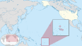 | ||||||||
|---|---|---|---|---|---|---|---|---|---|
| Listings |
| ||||||||
| Topics | |
|---|---|
| Lists by state |
|
| Lists by insular areas | |
| Lists by associated state | |
| Other areas | |
| Related | |
|
| This article about a property in American Samoa on the National Register of Historic Places is a stub. You can help Wikipedia by expanding it. |
- History of American Samoa
- Monuments and memorials on the National Register of Historic Places
- Buildings and structures on the National Register of Historic Places in American Samoa
- Buildings and structures completed in 1920
- 1920s in American Samoa
- Oceania Registered Historic Places stubs
- American Samoa geography stubs