Rogers | |
|---|---|
 Rogers Location within the state of New Mexico  Rogers Rogers (the United States) | |
| Coordinates: 33°58′54″N 103°13′50″W / 33.98167°N 103.23056°W | |
| Country | United States |
| State | New Mexico |
| County | Roosevelt |
| Elevation | 4,226 ft (1,288 m) |
| Time zone | UTC-7 ( Mountain (MST)) |
| • Summer ( DST) | UTC-6 (MDT) |
| ZIP codes | 88132
[1] |
| Area code | 575 |
| GNIS feature ID | 894127 [2] |
Rogers is an unincorporated community in Roosevelt County, New Mexico, United States. The community is on New Mexico State Road 235, 6.8 miles (10.9 km) east-northeast of Dora. Rogers has a post office with ZIP code 88132. [1] [3]
References
- ^ a b United States Postal Service. "USPS - Look Up a ZIP Code". Retrieved November 30, 2014.
- ^ "Rogers". Geographic Names Information System. United States Geological Survey, United States Department of the Interior.
- ^ "Postmaster Finder - Post Offices by ZIP Code". United States Postal Service. Retrieved November 30, 2014.
Municipalities and communities of
Roosevelt County, New Mexico, United States | ||
|---|---|---|
| City | 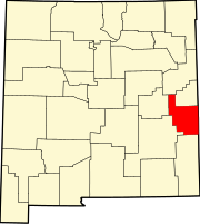 | |
| Town | ||
| Villages | ||
|
Unincorporated communities | ||
| Ghost towns | ||
|
| This New Mexico state location article is a stub. You can help Wikipedia by expanding it. |