Rožni Vrh | |
|---|---|
| Coordinates: 46°18′15.35″N 15°15′30.52″E / 46.3042639°N 15.2584778°E | |
| Country |
|
| Traditional region | Styria |
| Statistical region | Savinja |
| Municipality | Celje |
| Area | |
| • Total | 1.71 km2 (0.66 sq mi) |
| Elevation | 348 m (1,142 ft) |
| Population (2020) | |
| • Total | 149 |
| • Density | 87/km2 (230/sq mi) |
| [1] | |
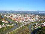
Rožni Vrh (pronounced [ˈɾoːʒni ˈʋəɾx]) is a settlement in the hills north of Celje in eastern Slovenia. The area is part of the traditional region of Styria. It is now included with the rest of the City Municipality of Celje in the Savinja Statistical Region. [2]
References
- ^ Statistical Office of the Republic of Slovenia Archived November 18, 2008, at the Wayback Machine
- ^ Celje municipal site
External links


