Rixeyville, Virginia | |
|---|---|
Unincorporated community | |
| Coordinates: 38°34′47″N 77°58′44″W / 38.57972°N 77.97889°W | |
| Country | United States |
| State | Virginia |
| County | Culpeper |
| Elevation | 446 ft (136 m) |
| Time zone | UTC-5 ( Eastern (EST)) |
| • Summer ( DST) | UTC-4 (EDT) |
| ZIP code | 22737 |
| Area code | 540 |
| GNIS feature ID | 1493497 [1] |
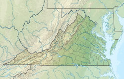
Rixeyville is an unincorporated community in Culpeper County, Virginia, United States. Rixeyville is located on Virginia State Route 229 7.4 miles (11.9 km) north of Culpeper. Rixeyville has a post office with ZIP code 22737, which opened on February 16, 1818. [2] [3]
The Rixey family owned plantations in the area before the American Civil War. U.S. Congressman John Franklin Rixey represented Virginia's 8th Congressional district for a decade (1897–1907).
References
- ^ "Rixeyville". Geographic Names Information System. United States Geological Survey, United States Department of the Interior.
- ^ United States Postal Service (2012). "USPS - Look Up a ZIP Code". Retrieved February 15, 2012.
- ^ "Postmaster Finder - Post Offices by ZIP Code". United States Postal Service. Archived from the original on October 17, 2020. Retrieved October 28, 2012.
Wikimedia Commons has media related to
Rixeyville, Virginia.


