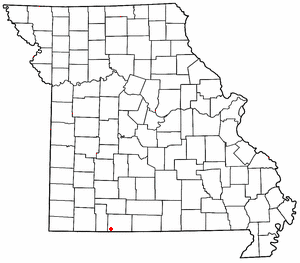
Ridgedale is an unincorporated community in southern Taney County, Missouri, United States. [1] It lies approximately ten miles south of Branson on U.S. Route 65, about one-half mile north of the Arkansas state line. [2] The community is part of the Branson, Missouri Micropolitan Statistical Area.
Ridgedale first had a post office in 1912, which closed the same year, and reopened in 1933, since which time it has remained open continuously. [3] The ZIP Code for Ridgedale is 65739. [4]
References
- ^ U.S. Geological Survey Geographic Names Information System: Ridgedale, Missouri
- ^ Missouri Atlas & Gazetteer, DeLorme, 1998, First edition, p. 62, ISBN 0-89933-224-2
- ^ "Taney". Missouri Postal History. Retrieved December 28, 2016.
- ^ "Ridgedale ZIP Code". zipdatamaps.com. 2022. Retrieved November 11, 2022.
36°30′14″N 93°13′26″W / 36.50389°N 93.22389°W
