You can help expand this article with text translated from
the corresponding article in German. (March 2009) Click [show] for important translation instructions.
|
Reisbach | |
|---|---|
 Town hall | |
.svg) Coat of arms | |
Location of Reisbach within Dingolfing-Landau district 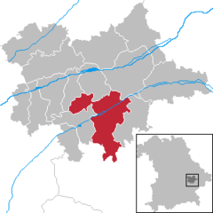 | |
 Reisbach  Reisbach | |
| Coordinates: 48°34′N 12°38′E / 48.567°N 12.633°E | |
| Country | Germany |
| State | Bavaria |
| Admin. region | Niederbayern |
| District | Dingolfing-Landau |
| Subdivisions | 7 Ortsteile |
| Government | |
| • Mayor (2020–26) | Rolf-Peter Holzleitner [1] ( FW) |
| Area | |
| • Total | 94.16 km2 (36.36 sq mi) |
| Elevation | 408 m (1,339 ft) |
| Population (2022-12-31)
[2] | |
| • Total | 7,894 |
| • Density | 84/km2 (220/sq mi) |
| Time zone | UTC+01:00 ( CET) |
| • Summer ( DST) | UTC+02:00 ( CEST) |
| Postal codes | 94419 |
| Dialling codes | 08734 08735 ( Bachham) |
| Vehicle registration | DGF |
| Website |
www |
Reisbach is a market town in Bavaria. It lies on the Vils River, and belongs to the administrative region of Niederbayern.

Neighbouring communities
The neighbouring communities, listed clockwise, are Mamming, Landau an der Isar, Simbach (bei Landau), Falkenberg (Niederbayern), Rimbach (Niederbayern), Gangkofen, Marklkofen and Gottfrieding.
Populated places
- Englmannsberg
- Griesbach
- Niederhausen
- Oberhausen
- Obermünchsdorf
- Reith
- Thannenmais
References
- ^ Liste der ersten Bürgermeister/Oberbürgermeister in kreisangehörigen Gemeinden, Bayerisches Landesamt für Statistik, 15 July 2021.
- ^ Genesis Online-Datenbank des Bayerischen Landesamtes für Statistik Tabelle 12411-003r Fortschreibung des Bevölkerungsstandes: Gemeinden, Stichtag (Einwohnerzahlen auf Grundlage des Zensus 2011) ( Hilfe dazu).
Places adjacent to Reisbach (Vils) | ||||||||||||||||
|---|---|---|---|---|---|---|---|---|---|---|---|---|---|---|---|---|
| ||||||||||||||||
Towns and municipalities in
Dingolfing-Landau | ||
|---|---|---|
| International | |
|---|---|
| National | |
| Geographic | |
|
| This Dingolfing-Landau location article is a stub. You can help Wikipedia by expanding it. |