-
 Village of Ramsau
 -
 The Church of St. Sebastian
You can help expand this article with text translated from
the corresponding article in German. (April 2024) Click [show] for important translation instructions.
|
Ramsau bei Berchtesgaden | |
|---|---|
 The Church of St. Sebastian, with the
Reiter Alpe in background | |
 Coat of arms | |
Location of Ramsau bei Berchtesgaden within Berchtesgadener Land district 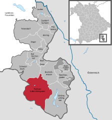 | |
 Ramsau bei Berchtesgaden  Ramsau bei Berchtesgaden | |
| Coordinates: 47°36′26″N 12°53′42″E / 47.60722°N 12.89500°E | |
| Country | Germany |
| State | Bavaria |
| Admin. region | Oberbayern |
| District | Berchtesgadener Land |
| Government | |
| • Mayor (2020–26) | Herbert Gschoßmann [1] ( CSU) |
| Area | |
| • Total | 129.18 km2 (49.88 sq mi) |
| Elevation | 670 m (2,200 ft) |
| Population (2022-12-31)
[2] | |
| • Total | 1,736 |
| • Density | 13/km2 (35/sq mi) |
| Time zone | UTC+01:00 ( CET) |
| • Summer ( DST) | UTC+02:00 ( CEST) |
| Postal codes | 83486 |
| Dialling codes | 08657 |
| Vehicle registration | BGL |
| Website | www.ramsau.de |
Ramsau is a German municipality in the Bavarian Alps with a population of around 1,800. It is a district located in the Berchtesgadener Land in Bavaria, close to the border with Austria, 35 km south of Salzburg and 150 km south-east of Munich. It is situated north of the Berchtesgaden National Park.
Notable sights of Ramsau include the third highest mountain in Germany called the Watzmann, Lake Hintersee, and the village's church.
Gallery


Notable people
- Wolfgang Bartels
- Hans Brandner
- Hermann Buhl
- Mirko Eichhorn
- Carolin Fernsebner
- Franz Graßl
- Hartmut Graßl
- Judith Graßl
- Johann Grill
- Matej Juhart
- Will Klinger-Franken
- Manuel Machata
- Anton Palzer
- Franz Pöschl
- Armin Roßmeier
- Willy Schlieker
References
- ^ Liste der ersten Bürgermeister/Oberbürgermeister in kreisangehörigen Gemeinden Archived 2021-06-30 at the Wayback Machine, Bayerisches Landesamt für Statistik, accessed 19 July 2021.
- ^ Genesis Online-Datenbank des Bayerischen Landesamtes für Statistik Tabelle 12411-003r Fortschreibung des Bevölkerungsstandes: Gemeinden, Stichtag (Einwohnerzahlen auf Grundlage des Zensus 2011).
-
 Media related to
Ramsau bei Berchtesgaden at Wikimedia Commons
Media related to
Ramsau bei Berchtesgaden at Wikimedia Commons
Towns and municipalities in
Berchtesgadener Land | ||
|---|---|---|
 | ||
| International | |
|---|---|
| National | |
| Geographic | |