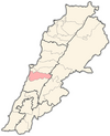
Qamatiyeh
قماطية | |
|---|---|
Town | |
| Coordinates: 33°48′05″N 35°34′47″E / 33.80139°N 35.57972°E | |
| Country | Lebanon |
| Governorate | Mount Lebanon |
| District | Aley |
| City | Aley |
| Area | |
| • Total | 0.87 km2 (0.34 sq mi) |
| Time zone | UTC+2 |
| • Summer ( DST) | UTC+3 |
| ISO 3166 code | LB |
Qmatiye ( Arabic: قماطية) is a village in Aley District in the Mount Lebanon Governorate of Lebanon. It lies right beneath the town of Souk El Gharb. The village has a small population and is a famous tourist attraction in the summer.
History
When Mamluks intensified their persecution against Shia Muslims in 1363, a group of Shiites from Beirut ( Burj Beirut) settled in Qmatiye and Kayfoun, the only major Shia villages in Aley District. [2]
In 1838, Eli Smith noted the place, called el-Kummatiyeh, located in El-Ghurb el-Fokany, upper el-Ghurb. [3]
Demographics
Qmatiye's natives are predominantly Shia Muslims with Christian and Sunni minorities.
Main families in the village are:
- Nassereddine
- Hamade
- Jaafar
- Zarwi
- Awada
- Doughaily
- Salloukh
- Chu'aib
References
- ^ Qamatiyeh, Localiban
- ^ Al-Muhajir, Jaafar (2017). The Imami Jurisprudence: its Origins and Schools. Center Of Civilization For the Development Of Islamic Thought. ISBN 9786144271254.
- ^ Robinson and Smith, 1841, vol 3, 2nd appendix, p. 191
Bibliography
External links
- Qamatiyeh, Localiban

