Punta San Juan Airport | |||||||||||
|---|---|---|---|---|---|---|---|---|---|---|---|
| Summary | |||||||||||
| Airport type | Public | ||||||||||
| Serves | Corral De Mulas | ||||||||||
| Elevation AMSL | 3 ft / 1 m | ||||||||||
| Coordinates | 13°10′40″N 88°28′25″W / 13.17778°N 88.47361°W | ||||||||||
| Map | |||||||||||
| Runways | |||||||||||
| |||||||||||
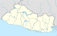
Punta San Juan Airport ( ICAO: MSSJ) is an airport serving the village of Corral De Mulas in Usulután Department, El Salvador. The unmarked grass runway is 7 kilometres (4.3 mi) east of the village on Punta San Juan, the western shore of the entrance to Bahia de Jiquilisco. Corral de Mulas is also served by Corral de Mulas Airport.
The El Salvador VOR-DME (Ident: CAT) is located 37.1 nautical miles (68.7 km) west-northwest of the airstrip. [3]
See also
References
External links
- OpenStreetMap - Punta San Juan
- HERE/Nokia - Punta San Juan
- FalllingRain - Punta San Juan
- Accident history for MSSJ at Aviation Safety Network
