Highway 690 | ||||
|---|---|---|---|---|
| Ruta 690 | ||||
| Route information | ||||
| Maintained by Puerto Rico DTPW | ||||
| Length | 7.6 km [1] (4.7 mi) | |||
| Existed | 1953 [2]–present | |||
| Major junctions | ||||
| South end | ||||
| North end | Calle Principal in Sabana | |||
| Location | ||||
| Country | United States | |||
| Territory | Puerto Rico | |||
| Municipalities | Vega Alta | |||
| Highway system | ||||
| ||||
| ||||

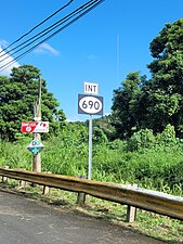
Puerto Rico Highway 690 (PR-690) is a north–south road located entirely in the municipality of Vega Alta, Puerto Rico. [3] With a length of 7.6 kilometers (4.7 mi), [1] it begins at its junction with PR-676 in Bajura barrio and ends at Cerro Gordo Beach in Sabana barrio. [4] [5]
- Puerto Rico Highway 690
-
 Heading south in Bajura barrio
 -
 Heading south in Sabana barrio
.jpg)
.jpg)
Major intersections
The entire route is located in Vega Alta.
-
 PR-2 west near PR-690 junction in Bajura barrio
 -
 PR-2 west at PR-690 junction in Bajura barrio
.jpg)
.jpg)
| Location | km [1] | mi | Destinations | Notes | |
|---|---|---|---|---|---|
| Bajura | 0.0 | 0.0 | Southern terminus of PR-690 | ||
| 0.2 | 0.12 | ||||
| Sabana | 1.1 | 0.68 | PR-22 exit 31; one-way ramp; PR-22 access via PR-2 west | ||
| 2.2– 2.3 | 1.4– 1.4 | ||||
| 4.4 | 2.7 | ||||
| 5.2– 5.3 | 3.2– 3.3 | ||||
| 5.9 | 3.7 | ||||
| 6.0 | 3.7 | ||||
| 7.2 | 4.5 | ||||
| 7.6 | 4.7 | PR-Calle Principal – Sabana | Northern terminus of PR-690 | ||
| 1.000 mi = 1.609 km; 1.000 km = 0.621 mi | |||||
Related route
Highway 6690 | |
|---|---|
| Location | Vega Alta |
| Length | 2.7 km [6] (1.7 mi) |
Puerto Rico Highway 6690 (PR-6690) is a spur route that goes to PR-693 from PR-690 near Cerro Gordo Beach. [7] The entire route is located in Sabana, Vega Alta.
| km [6] | mi | Destinations | Notes | ||
|---|---|---|---|---|---|
| 0.0 | 0.0 | Southern terminus of PR-6690 | |||
| 2.7 | 1.7 | Northern terminus of PR-6690 | |||
| 1.000 mi = 1.609 km; 1.000 km = 0.621 mi | |||||
See also
References
- ^ a b c Google (20 March 2021). "PR-690" (Map). Google Maps. Google. Retrieved 20 March 2021.
- ^ "Vega Alta, Memoria Núm. 59" (PDF) (in Spanish). Puerto Rico Planning Board. 1955. Retrieved 7 May 2021.
- ^ National Geographic Maps (2011). Puerto Rico (Map). 1:125,000. Adventure Map (Book 3107). Evergreen, Colorado: National Geographic Maps. ISBN 978-1566955188. OCLC 756511572.
- ^ "Tránsito Promedio Diario (AADT)". Datos de Tránsito [Transit Data] (in Spanish). Puerto Rico Department of Transportation and Public Works. p. 123. Archived from the original on 1 April 2019. Retrieved 16 May 2021.
- ^ "PR-690, Vega Alta, Puerto Rico". geoview.info. Retrieved 16 May 2021.
- ^ a b Google (20 March 2021). "PR-6690" (Map). Google Maps. Google. Retrieved 20 March 2021.
- ^ "PR-6690, Vega Alta, Puerto Rico". geoview.info. Retrieved 16 May 2021.
External links
-
 Media related to
Puerto Rico Highway 690 and
Puerto Rico Highway 6690 at Wikimedia Commons
Media related to
Puerto Rico Highway 690 and
Puerto Rico Highway 6690 at Wikimedia Commons
|
| This Vega Alta, Puerto Rico location article is a stub. You can help Wikipedia by expanding it. |
|
| This Puerto Rico road-related article is a stub. You can help Wikipedia by expanding it. |