Highway 487 | ||||
|---|---|---|---|---|
| Ruta 487 | ||||
| Route information | ||||
| Maintained by Puerto Rico DTPW | ||||
| Length | 8.7 km [1] (5.4 mi) | |||
| Existed | 1953 [2]–present | |||
| Major junctions | ||||
| South end | ||||
| North end | ||||
| Location | ||||
| Country | United States | |||
| Territory | Puerto Rico | |||
| Municipalities | Hatillo | |||
| Highway system | ||||
| ||||

Puerto Rico Highway 487 (PR-487) is a north–south road located entirely in the municipality of Hatillo, Puerto Rico. [3] With a length of 8.7 kilometers (5.4 mi), [1] it begins at its intersection with PR-130 and PR-488 on the Naranjito– Buena Vista line, [4] and ends at its junction with PR-129 in Bayaney barrio. [5]
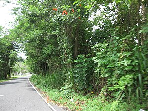
- Puerto Rico Highway 487
-
 Traveling south to north
 -
 Traveling south to north


Major intersections
The entire route is located in Hatillo.
-
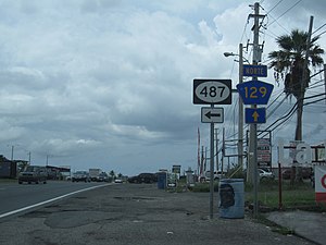 PR-129 north at PR-487 intersection in Bayaney barrio
 -
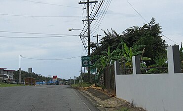 PR-487 north approaching PR-130 and PR-488 intersection


| Location | km [1] | mi | Destinations | Notes | |
|---|---|---|---|---|---|
| Bayaney | 8.7 | 5.4 | Southern terminus of PR-487 | ||
| Buena Vista– Naranjito line | 0.0 | 0.0 | Northern terminus of PR-487 | ||
| 1.000 mi = 1.609 km; 1.000 km = 0.621 mi | |||||
See also
References
- ^ a b c Google (3 August 2020). "PR-487" (Map). Google Maps. Google. Retrieved 3 August 2020.
- ^ "Hatillo, Memoria Núm. 63" (PDF). Puerto Rico Planning Board (in Spanish). 1954. Retrieved 3 August 2020.
- ^ National Geographic Maps (2011). Puerto Rico (Map). 1:125,000. Adventure Map (Book 3107). Evergreen, Colorado: National Geographic Maps. ISBN 978-1566955188. OCLC 756511572.
- ^ "PR-487, Hatillo, Puerto Rico". geoview.info. Retrieved 3 August 2020.
- ^ "Tránsito Promedio Diario (AADT)". Transit Data (Datos de Tránsito) (in Spanish). Puerto Rico Department of Transportation and Public Works. p. 113. Archived from the original on 1 April 2019. Retrieved 3 August 2020.
External links
-
 Media related to
Puerto Rico Highway 487 at Wikimedia Commons
Media related to
Puerto Rico Highway 487 at Wikimedia Commons
|
| This Puerto Rico road-related article is a stub. You can help Wikipedia by expanding it. |