Highway 438 | ||||
|---|---|---|---|---|
| Ruta 438 | ||||
| Route information | ||||
| Maintained by Puerto Rico DTPW | ||||
| Length | 1.7 km [1] (1.1 mi) | |||
| Major junctions | ||||
| West end | ||||
| East end | Barrio Juncal | |||
| Location | ||||
| Country | United States | |||
| Territory | Puerto Rico | |||
| Municipalities | San Sebastián | |||
| Highway system | ||||
| ||||

Puerto Rico Highway 438 (PR-438) is a rural road located entirely in the municipality of San Sebastián, Puerto Rico. [2] With a length of 1.7 kilometers (1.1 mi), [1] it begins at its intersection with PR-111 on the Eneas– Cidral– Magos tripoint, and ends near PR-111 in Juncal barrio. [3]
-
 Cuesta de Magos (PR-438) in Magos barrio
 -
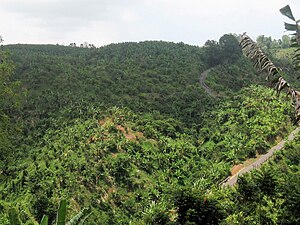 Cuesta de Magos seen from Calabazas barrio


Major intersections
The entire route is located in San Sebastián.
-
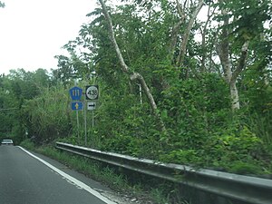 PR-111 east at the western terminus of PR-438

| Location | km [1] | mi | Destinations | Notes | |
|---|---|---|---|---|---|
|
Eneas–
Cidral– Magos tripoint | 0.0 | 0.0 | Western terminus of PR-438 | ||
| Juncal | 1.7 | 1.1 | Eastern terminus of PR-438 | ||
| 1.000 mi = 1.609 km; 1.000 km = 0.621 mi | |||||
See also
References
- ^ a b c Google (14 August 2020). "PR-438" (Map). Google Maps. Google. Retrieved 14 August 2020.
- ^ National Geographic Maps (2011). Puerto Rico (Map). 1:125,000. Adventure Map (Book 3107). Evergreen, Colorado: National Geographic Maps. ISBN 978-1566955188. OCLC 756511572.
- ^ "Carretera 438, San Sebastián, Puerto Rico". geoview.info. Retrieved 14 August 2020.
External links
-
 Media related to
Puerto Rico Highway 438 at Wikimedia Commons
Media related to
Puerto Rico Highway 438 at Wikimedia Commons
|
| This Puerto Rico road-related article is a stub. You can help Wikipedia by expanding it. |