Highway 159 | ||||
|---|---|---|---|---|
| Ruta 159 | ||||
| Route information | ||||
| Maintained by Puerto Rico DTPW | ||||
| Length | 20.6 km [1] (12.8 mi) | |||
| Existed | 1953 [2] [3] [4]–present | |||
| Major junctions | ||||
| West end | ||||
| East end | ||||
| Location | ||||
| Country | United States | |||
| Territory | Puerto Rico | |||
| Municipalities | Morovis, Corozal, Toa Alta | |||
| Highway system | ||||
| ||||


Puerto Rico Highway 159 (PR-159) is the main road from Morovis to Toa Alta, passing through the municipality of Corozal in Puerto Rico. [5] This road begins in downtown Morovis, from its intersection with PR-155 and PR-6623 to its junction with PR-165 in Toa Alta. It is about 21 km (13 mi) long. [6]
Route description
This highway consists of one lane in each direction for most of its length between Morovis and Toa Alta. In Morovis, PR-159 travels from its intersection with PR-155 and PR-6623 in downtown to the Corozal municipal limit, crossing through Monte Llano and Unibón barrios. [7] In Corozal, the road serves as the main access to some neighborhoods, [8] including Padilla, Cibuco, Dos Bocas, Barrio Pueblo, downtown Corozal, Palmarejo and Abras. [9] Through downtown Corozal, the route was replaced by PR-891, and PR-159 makes a bypass to evade the municipal center. In Toa Alta, PR-159 crosses though Quebrada Arenas barrio until its ending at PR-165 on the Quebrada Arenas– Quebrada Cruz line. [10]
Among the most important intersections are PR-137 (Expreso Ángel "Tony" Laureano), that heads to Vega Baja; PR-142 (Expreso de Corozal), that goes to Dorado; PR-155, the main highway between Vega Baja and Orocovis; PR-160, a route between Morovis and eastern Vega Baja; PR-164, the main highway to Naranjito, and PR-165, the main road between Toa Alta and Naranjito. On this highway lies the Plaza Aquarium shopping center, located in Toa Alta, and Mavilla Bridge, a centenary bridge which is located east of Corozal. [11]
-
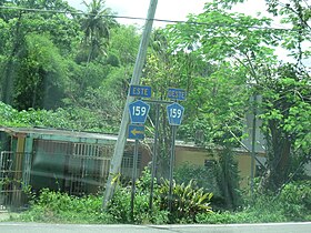 Signs for Puerto Rico Highway 159 east and west in Morovis
 -
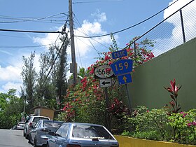
 Signs for PR-159 and PR-807 in Corozal barrio-pueblo
 -
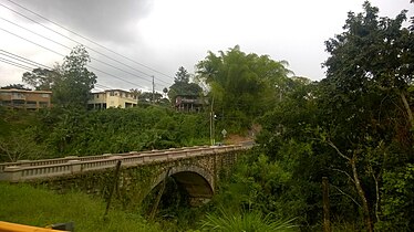 Mavilla Bridge in Corozal

.jpg)

Rivers crossed
Puerto Rico Highway 159 crosses the following rivers:
- Río Cibuco in Corozal [12]
- Río Corozal in Corozal [13]
- Río Mavilla in Corozal [14]
- Río Unibón in Morovis [15]
History
Puerto Rico Highway 159 is part of original segments of old Roads No. 10 and No. 20 that existed until the 1953 Puerto Rico highway renumbering, a process implemented by the Puerto Rico Department of Transportation and Public Works ( Spanish: Departamento de Transportación y Obras Públicas) that increased the insular highway network to connect existing routes with different locations around Puerto Rico. [16] Road No. 10 was the highway that led from Dorado to Coamo through Toa Alta, Corozal and Orocovis, [4] [17] [18] while Road No. 20 was a route from Naranjito to Ciales across Corozal and Morovis. [19] [3] [2]
Maintenance
The issue of who is responsible for the road maintenance in Morovis was argued in April 2019. Representative Guillermo Miranda Rivera accused the mayor of Morovis, Carmen Maldonado González, of not doing road maintenance on Morovis' roads, while she blamed the central government for the condition of state roads in Morovis. [20]
-
 Puerto Rico Highway 159 east in Morovis
 -
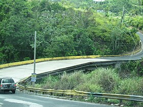 Bridge with Puerto Rico Highway 159 over Unibón River

.jpg)
Major intersections
| Municipality | Location | km [1] | mi | Destinations | Notes |
|---|---|---|---|---|---|
| Morovis | Morovis barrio-pueblo | 0.0 | 0.0 | Western terminus of PR-159; PR-155 northbound access via PR-6617 | |
| Monte Llano | 0.2– 0.3 | 0.12– 0.19 | PR-159 westbound detour | ||
| 0.5 | 0.31 | ||||
| 2.0 | 1.2 | ||||
| Unibón | 5.1– 5.2 | 3.2– 3.2 | |||
| 5.2– 5.3 | 3.2– 3.3 | ||||
| Corozal | Padilla– Cibuco line | 7.5 | 4.7 | ||
| 8.8– 8.9 | 5.5– 5.5 | PR-817 – Cibuco | Unsigned | ||
| 9.9– 10.0 | 6.2– 6.2 | ||||
| Corozal barrio-pueblo– Pueblo line | 13.4 | 8.3 | Western terminus of Avenida José Julián Grana Rodríguez | ||
| Pueblo | 13.6– 13.7 | 8.5– 8.5 | |||
| Corozal barrio-pueblo– Pueblo line | 14.6 | 9.1 | |||
| Pueblo | 15.1– 15.2 | 9.4– 9.4 | |||
| 15.5– 15.6 | 9.6– 9.7 | Eastern terminus of Avenida José Julián Grana Rodríguez | |||
| Pueblo– Palmarejo line | 16.0 | 9.9 | |||
| Palmarejo– Abras line | 17.9– 18.0 | 11.1– 11.2 | Puente de Mavilla over the Río Mavilla [21] | ||
| 19.0– 19.1 | 11.8– 11.9 | ||||
| Toa Alta | Quebrada Arenas– Quebrada Cruz line | 20.6 | 12.8 | Eastern terminus of PR-159 | |
1.000 mi = 1.609 km; 1.000 km = 0.621 mi
| |||||
See also
References
- ^ a b Google (28 February 2020). "PR-159" (Map). Google Maps. Google. Retrieved 28 February 2020.
- ^ a b "Morovis, Memoria Núm. 65" (PDF). Puerto Rico Planning Board (in Spanish). 1955. Archived (PDF) from the original on 11 April 2021. Retrieved 22 February 2020.
- ^ a b "Corozal, Memoria Núm. 61" (PDF). Puerto Rico Planning Board (in Spanish). 1955. Archived (PDF) from the original on 2 November 2020. Retrieved 6 August 2023.
- ^ a b "Toa Alta, Memoria Núm. 57" (PDF). Puerto Rico Planning Board (in Spanish). 1955. Archived (PDF) from the original on 6 August 2023. Retrieved 6 August 2023.
- ^ National Geographic Maps (2011). Puerto Rico (Map). 1:125,000. Adventure Map (Book 3107). Evergreen, Colorado: National Geographic Maps. ISBN 978-1566955188. OCLC 756511572.
- ^ Puerto Rico Department of Transportation and Public Works. "Datos de Transito 2000-2009" (in Spanish). Archived from the original on 1 April 2019. Retrieved 29 April 2019.
- ^ "Pr- 159, Morovis, Puerto Rico". pr.geoview.info. Archived from the original on 6 August 2023. Retrieved 6 August 2023.
- ^ InterNewsService (26 April 2018). "DTOP iniciará trabajos en peligrosa carretera de Corozal". El Vocero de Puerto Rico (in Spanish). Archived from the original on 28 July 2019. Retrieved 28 July 2019.
- ^ "PR-159, Corozal, Puerto Rico". pr.geoview.info. Archived from the original on 6 August 2023. Retrieved 6 August 2023.
- ^ "PR-159, Toa Alta, Puerto Rico". pr.geoview.info. Archived from the original on 6 August 2023. Retrieved 6 August 2023.
- ^ "NPGallery Asset Detail". npgallery.nps.gov. Archived from the original on 10 April 2021. Retrieved 6 August 2023.
- ^ Press, Detroit Free. "PR 159 over CIBUCO RIVER Corozal Municipio, Puerto Rico Bridge Inspection Report". Detroit Free Press. Archived from the original on 10 August 2023. Retrieved 9 August 2023.
- ^ Press, Detroit Free. "PR 159 over COROZAL RIVER Corozal Municipio, Puerto Rico Bridge Inspection Report". Detroit Free Press. Archived from the original on 10 August 2023. Retrieved 9 August 2023.
- ^ Press, Detroit Free. "PR 159 over MAVILLA RIVER Corozal Municipio, Puerto Rico Bridge Inspection Report". Detroit Free Press. Archived from the original on 10 August 2023. Retrieved 9 August 2023.
- ^ Press, Detroit Free. "PR 159 over UNIBON RIVER Morovis Municipio, Puerto Rico Bridge Inspection Report". Detroit Free Press. Archived from the original on 10 August 2023. Retrieved 9 August 2023.
- ^ "Revista de Obras Públicas de Puerto Rico, Febrero 1929". Colección Puertorriqueña UPR RP (in Spanish). 1929. pp. 22–23. Archived from the original on 6 August 2023. Retrieved 6 August 2023.
- ^ "Orocovis, Memoria Núm. 47" (PDF). Puerto Rico Planning Board (in Spanish). 1955. Archived (PDF) from the original on 5 April 2023. Retrieved 6 August 2023.
- ^ "Coamo, Memoria Núm. 33" (PDF). Puerto Rico Planning Board (in Spanish). 1953. Archived (PDF) from the original on 6 August 2023. Retrieved 6 August 2023.
- ^ "Naranjito, Memoria Núm. 53" (PDF). Puerto Rico Planning Board (in Spanish). 1955. Archived (PDF) from the original on 5 April 2023. Retrieved 6 August 2023.
- ^ "Como papa caliente responsabilidad de las carreteras en Morovis". NOTICEL. 17 March 2019. Archived from the original on 7 July 2022. Retrieved 2 September 2023.
- ^ Luis F. Pumarada O’Neill (1991). "Los Puentes Históricos de Puerto Rico" (PDF) (in Spanish). pp. 57–58. Archived from the original on 24 March 2020. Retrieved 10 March 2020.
External links
- Reabre tramo de la PR-159 en Corozal (in Spanish)
- Piden tomar acción para reparar carretera en Morovis (in Spanish)
- Inician los trabajos en la carretera #159 de Morovis (in Spanish)