Highway 115 | ||||
|---|---|---|---|---|
| Ruta 115 | ||||
| Avenida Profesor Tomás Bonilla Feliciano [1] | ||||
| Route information | ||||
| Maintained by Puerto Rico DTPW | ||||
| Length | 27.8 km [2] (17.3 mi) | |||
| Major junctions | ||||
| South end | ||||
| North end | ||||
| Location | ||||
| Country | United States | |||
| Territory | Puerto Rico | |||
| Municipalities | Añasco, Rincón, Aguada, Aguadilla | |||
| Highway system | ||||
| ||||
| ||||


Puerto Rico Highway 115 (PR-115) is a highway which follows the west coastline of Puerto Rico from south Añasco at PR-2 to near downtown Aguadilla, where it becomes Puerto Rico Highway 111 after intersecting PR-2 again, [3] and is the primary route to the town of Rincón, Puerto Rico, [4] a tourist and frequent destination of surfers.
Route description
As it enters Rincón, PR-115 becomes a divided highway with one lane per direction, with the median filled with trees, similar to some of the medians found in freeways in the United States. But PR-115 is not a freeway; it is a rural highway mostly one lane per direction. It enters toward downtown Rincón. The highway is subject to severe flooding when it rains. [5]
-
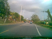 PR-115 in Aguada
 -
 View from El Mirador de la Bahía in Caguabo off PR-115


Major intersections
| Municipality | Location | km [2] | mi | Destinations | Notes |
|---|---|---|---|---|---|
| Añasco | Añasco Abajo | 0.0 | 0.0 | Southern terminus of PR-115 | |
| Hatillo | 3.3 | 2.1 | |||
| 4.3 | 2.7 | ||||
| Caguabo | 6.9 | 4.3 | |||
| Rincón | Calvache | 8.7 | 5.4 | ||
| 10.3 | 6.4 | ||||
| Rincón barrio-pueblo | 13.2 | 8.2 | One-way street | ||
| 13.3– 13.4 | 8.3– 8.3 | ||||
| 13.6 | 8.5 | ||||
| Río Grande | 15.4 | 9.6 | |||
| 17.2 | 10.7 | ||||
| Aguada | Guayabo | 20.4 | 12.7 | ||
| Guaniquilla– Guayabo line | 21.8 | 13.5 | PR-Avenida Nativo Alers – Aguada | ||
| 22.6– 22.7 | 14.0– 14.1 | PR-441 access via Calle Jiménez | |||
| Aguada barrio-pueblo | 23.2– 23.3 | 14.4– 14.5 | One-way street | ||
| Asomante | 24.6 | 15.3 | Former PR-115R | ||
| 25.9 | 16.1 | ||||
| Carrizal | 26.8 | 16.7 | |||
| Río Culebrinas | 26.8– 26.9 | 16.7– 16.7 | Puente Conde de Caspe [6] | ||
| Espinar | 27.1 | 16.8 | |||
| Aguadilla | Victoria | 27.8 | 17.3 | Northern terminus of PR-115 | |
| 1.000 mi = 1.609 km; 1.000 km = 0.621 mi | |||||
Related route
Highway 115 Spur | |
|---|---|
| Location | Aguada |
| Length | 1.2 km [7] (0.75 mi) |
| Existed | y |
Highway 115 Spur ( Spanish: Carretera Ramal 115, abbreviated Ramal PR-115 or PR-115R) is a road that branches off from PR-115 to PR-417 near downtown Aguada. [8] Currently the entire road was renumbered to PR-4415. [9] The entire route is located in Aguada.
| Location | km [7] | mi | Destinations | Notes | |
|---|---|---|---|---|---|
| Piedras Blancas– Asomante line | 1.2 | 0.75 | Southern terminus of PR-115R | ||
| Asomante | 0.0 | 0.0 | Northern terminus of PR-115R | ||
| 1.000 mi = 1.609 km; 1.000 km = 0.621 mi | |||||
See also
References
- ^ "Para designar la Carretera Estatal PR-115 como "Avenida Profesor Tomás Bonilla Feliciano"". LexJuris (Leyes y Jurisprudencia) de Puerto Rico (in Spanish). 2018. Retrieved 1 June 2019.
- ^ a b Google (11 March 2020). "PR-115" (Map). Google Maps. Google. Retrieved 11 March 2020.
- ^ National Geographic Maps (2011). Puerto Rico (Map). 1:125,000. Adventure Map (Book 3107). Evergreen, Colorado: National Geographic Maps. ISBN 978-1566955188. OCLC 756511572.
- ^ "Tránsito Promedio Diario (AADT)". Transit Data (in Spanish). DTOP PR. p. 65. Archived from the original on 1 April 2019.
- ^ "Reabren tramo en la PR-115 tras desbordamiento de Río Culebrinas". La Isla Oeste (in Spanish). 28 May 2019. Retrieved 17 December 2021.
- ^ Luis F. Pumarada O’Neill (1991). "Los Puentes Históricos de Puerto Rico" (PDF) (in Spanish). p. 114. Retrieved 11 March 2020.
- ^ a b Google (6 April 2023). "PR-115R" (Map). Google Maps. Google. Retrieved 6 April 2023.
- ^ "PR-115R, Aguada, Puerto Rico". pr.geoview.info. Retrieved 6 April 2023.
- ^ "Mapa Vial de Aguada" (PDF). Junta de Planificación (in Spanish). Retrieved 6 April 2023.
External links
|
| This Puerto Rican location article is a stub. You can help Wikipedia by expanding it. |
|
| This Puerto Rico road-related article is a stub. You can help Wikipedia by expanding it. |