Psary | |
|---|---|
Village | |
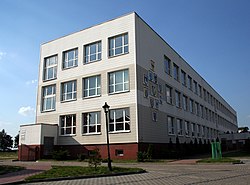
 High school in Psary | |
| Coordinates: 50°36′51″N 18°58′2″E / 50.61417°N 18.96722°E | |
| Country | |
| Voivodeship | Silesian |
| County | Lubliniec |
| Gmina | Woźniki |
| Population | 1,304 |
| Time zone | UTC+1 ( CET) |
| • Summer ( DST) | UTC+2 ( CEST) |
| Vehicle registration | SLU |
| Primary airport | Katowice Airport |
Psary [ˈpsarɨ] is a village in the administrative district of Gmina Woźniki, within Lubliniec County, Silesian Voivodeship, in southern Poland. [1] It lies approximately 22 km (14 mi) east of Lubliniec and 41 km (25 mi) north of the regional capital Katowice.
The name of the village is of Polish origin and comes from the word pies, which means "dog". [2]
Sports
The local football club is Orzeł Psary-Babienica. [3] It competes in the lower leagues.
References
- ^ "Central Statistical Office (GUS) - TERYT (National Register of Territorial Land Apportionment Journal)" (in Polish). 2008-06-01.
- ^ Adamy, Heinrich (1888). Die schlesischen Ortsnamen, ihre Entstehung und Bedeutung. Ein Bild aus der Vorzeit (in German). Verlag von Priebatsch's Buchhandlung. p. 60.
- ^ "LKS Orzeł Psary-Babienica" (in Polish). Retrieved 26 December 2022.

