| Port of Port Arthur | |
|---|---|
 | |
|
Click on the map for a fullscreen view | |
| Location | |
| Country | United States |
| Location | Port Arthur, Texas |
| Coordinates | 29°52′02″N 93°56′13″W / 29.867099°N 93.936927°W |
| UN/LOCODE | USFPO [1] |
| Details | |
| Draft depth | Depth 49 feet (15 m) [2] |
| Statistics | |
| Website http://www.portofportarthur.com | |
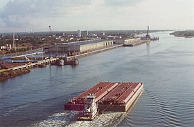
The Port of Port Arthur is a seaport in Port Arthur, Texas ( United States).
2010 tanker collision
On 23 January 2010, an oil tanker and barge collided in the channel leading to Port Arthur, spilling up to 450,000 gallons of oil into the seaway. The tanker was chartered by ExxonMobil and was bound for Exxon's refinery in Beaumont, Texas. [3]
References
- ^ "UNLOCODE (US) - UNITED STATES". service.unece.org. Retrieved 24 March 2021.
- ^ "Port of Port Arthur, U.S.A." www.findaport.com. Shipping Guides Ltd. Retrieved 24 March 2021.
- ^ Gonzalez, Angel (24 January 2010). "Collision Causes Crude Oil Spill in Texas". The Wall Street Journal. Retrieved 24 January 2010.
External links
Wikimedia Commons has media related to
Port of Port Arthur.